Towering Canyon Walls Along the Virgin River
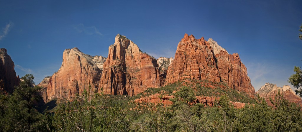
Zion National Park—established as Utah’s first national park—in 1919 is one of the most visited and rewarding destinations in the American Southwest, offering something for a wide range of visitors, from families and casual walkers to more experienced hikers. Its central canyon, carved by the Virgin River, is easy to navigate by e‑bike or the park shuttle system, as private cars are not allowed in the main canyon for most of the year, allowing visitors to move between key viewpoints and trailheads without the need for long drives. This makes it possible to experience the landscape comfortably, even on a limited schedule.
For those looking to explore on foot, Zion offers a mix of well-maintained paths and more challenging hikes. Riverside walks, paved trails, and short scenic routes provide plenty of opportunities to experience the canyon up close without committing to strenuous climbs. At the same time, well-known hikes like Angels Landing or The Narrows attract those seeking a more active experience. This balance makes Zion especially appealing for groups with different interests and energy levels.
Even without extensive hiking, Zion delivers a strong sense of place simply through its scale and setting. The canyon walls rise sharply from the valley floor, and viewpoints throughout the park offer changing perspectives as the light shifts during the day. Whether walking along the river, riding the shuttle, or stopping at overlooks, the experience is as much about taking in the surroundings as it is about covering distance. For many visitors, Zion serves as a natural starting point for exploring the broader landscapes of southern Utah.
How to navigate with your mobile device
JCVWalks are designed to be easy to follow on your mobile device. As you travel from point to point, you can tap the header or photo for each point of interest to open the location directly in Google Maps. This will help you navigate from your current location to the next point of interest. If you’d like to learn more about any stop along the way, just click the links in the description for additional details and context.
Drive to Zion National Park
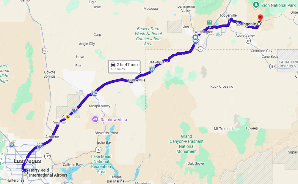
Our journey has us driving from Las Vegas through the Virgin River Gorge offering one of the first memorable sections of our journey. Interstate 15 cuts directly through this narrow canyon, following the river as it winds between steep, layered walls of rock. Completed in the 1970s, this stretch of highway is considered an engineering achievement, built to navigate terrain that had long been difficult to cross. There are a few pullouts and nearby areas where we can pause and take in the scale of the gorge up close if time allows.
Springdale, Utah
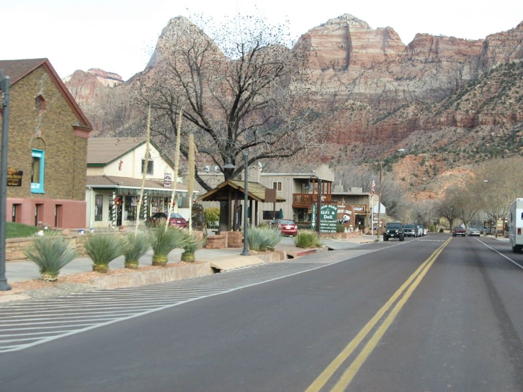
As we approach Zion National Park, Springdale serves as our gateway and base for exploring the area. The town stretches along Zion Park Boulevard, which functions as its main street, lined with hotels, restaurants, outfitters, and small shops that support visitors heading into the park. Many of these shops offer e-bike rentals, gear, and guidance to help explore the canyon more easily or prepare for a day of hiking. Despite its role as a hub, Springdale is worth experiencing in its own right. Surrounded by red rock cliffs, it offers constant views of the landscape that define Zion. A free shuttle system connects Springdale to the Zion Canyon shuttle, making it easy for us to access the park without a car. It’s a convenient and scenic place to settle in before beginning our time in Zion.
Two-Day Itinerary
Our two-day experience begins with a relaxed afternoon arrival in Zion, offering a chance to orient ourselves to the park and its scale. After stopping at the Visitor Center to get our bearings, we will take an easy walk along the Pa’rus Trail, a flat riverside path that introduces the canyon’s towering walls and the flow of the Virgin River in a quiet, accessible setting.
Following dinner and a restful evening in Springdale, we will return the next morning for a full day in the canyon, exploring by e‑bike along the scenic drive. Riding the length of Zion Canyon provides a gradual, immersive experience of its changing landscapes—with time to step off the bike for short walks, take in key viewpoints, and experience the canyon from within rather than simply observing it from afar.
Getting Around: Town Shuttle and Zion Canyon Shuttle
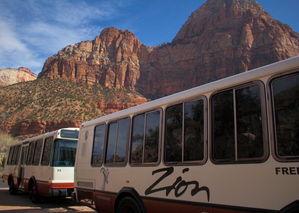
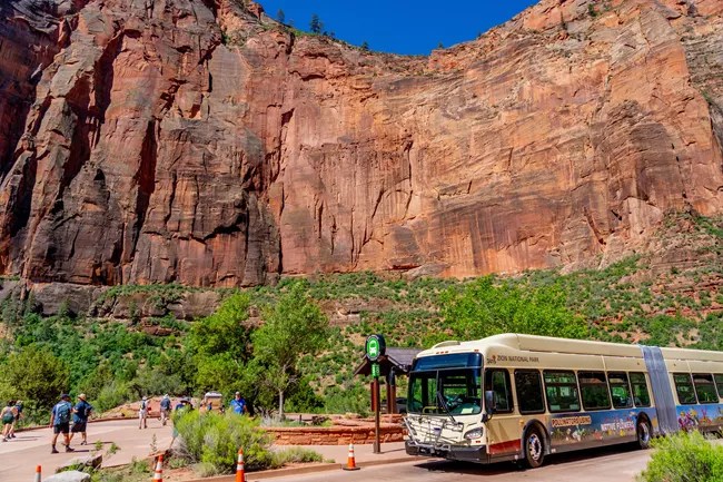
To make getting around easier, Zion operates a simple and efficient two-part shuttle system that connects Springdale with the main canyon. During most of the year—typically from spring through late fall—private cars are not allowed in Zion Canyon, so we rely on these shuttles to move through the park. The free Springdale Shuttle runs along Zion Park Boulevard, stopping at hotels, shops, and key points in town, usually every 10–15 minutes, and brings us to the park entrance. From there, we transfer to the Zion Canyon Shuttle, which continues into the canyon with frequent stops at major trailheads and viewpoints, running every 5–10 minutes during busy periods. Both systems are included with park admission and operate from early morning into the evening, allowing us to explore at our own pace without worrying about parking or traffic.
What about e-bikes?
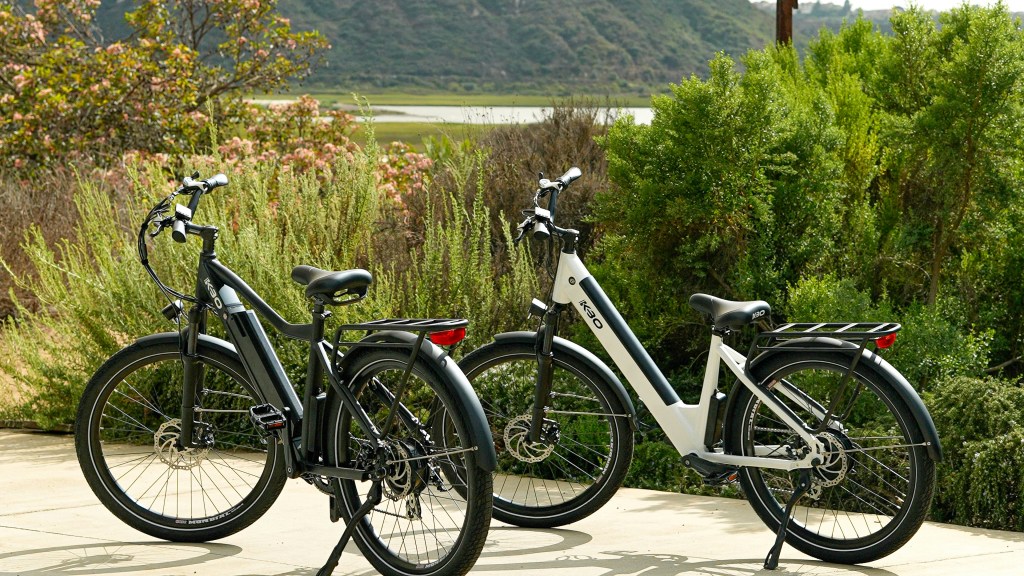
For our visit, we decided to rent e‑bikes as our primary way of getting around Zion Canyon. Beyond the practical benefits, we thought it would simply be a fun, additional layer to the experience. We had also heard about lines and crowds for the shuttle, particularly during busy periods, and wanted the flexibility to move at our own pace, stop where we chose, and avoid waiting. Assuming good weather, riding through the canyon gives us a more direct connection to the landscape. That said, e‑bikes may not be the right fit for everyone, and Zion’s shuttle system remains a reliable and well-designed alternative, making it easy to access the canyon and its trailheads without the need for a car.
Visitor’s Passes

If you’re planning to visit multiple national parks, we recommend purchasing the America the Beautiful National Park Pass. This $80 annual pass covers entrance and standard day-use fees at thousands of recreation sites managed by federal agencies, making it a good value for trips like this one. The pass is valid for 12 months from the date of purchase and can be ordered in advance through Recreation.gov in both digital and physical formats. For those age 62 and over, a lifetime senior pass is available at a reduced cost. In addition to saving on fees, pass purchases support park maintenance and visitor services, making it a practical and worthwhile investment.
Zion National Park Visitor’s Center
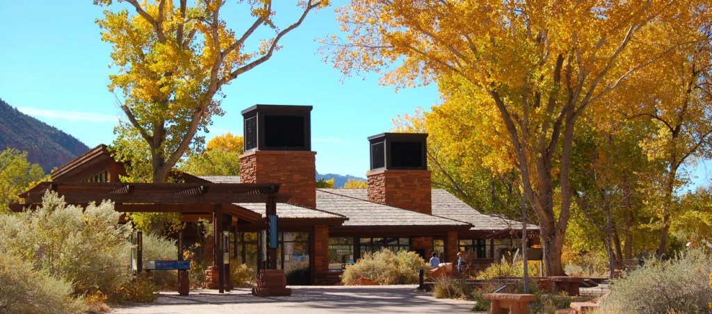
Before beginning our full day in the park, we will stop at the Zion Canyon Visitor Center, located near the South Entrance, to get oriented and make the most of our time in Zion. The visitor center is a helpful starting point, with park rangers available to answer questions, offer suggestions, and help us plan our route through the canyon. Outdoor exhibits provide useful context about the park’s landscape and history, while the bookstore offers maps, guides, and other resources. If we are considering more advanced hikes or activities, the nearby Wilderness Desk is the place to inquire about permits and current conditions. It’s a practical and worthwhile first stop before heading further into the canyon.
Park Introduction – Pa’rus Trail Walk
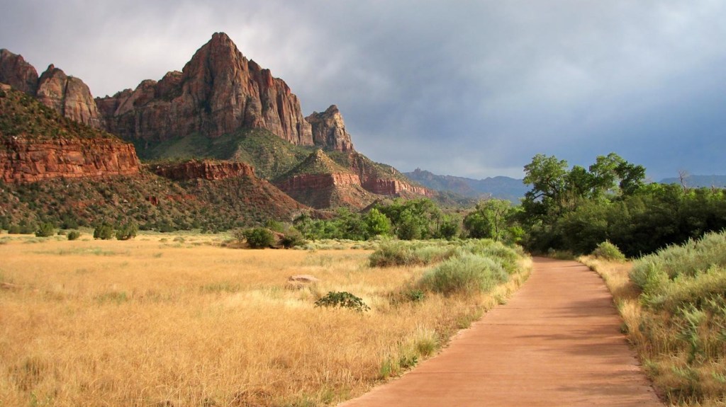
On our first afternoon in Zion, we ease into the experience with a relaxed walk along the Pa’rus Trail. After getting oriented at the visitor center, we make our way into the canyon—either by walking or taking the shuttle to Canyon Junction, where the landscape begins to open and views of the Watchman and surrounding cliffs come into focus. From there, we take a short detour to the bridge over the Virgin River for one of the classic early viewpoints in the park. We then follow the Pa’rus Trail back toward the Visitor Center, an easy, paved path that runs alongside the river. At roughly two miles with minimal elevation, it’s a comfortable walk that offers wide views of the canyon and a quieter introduction to Zion’s scale.
Full Day Itinerary
Temple of Sinawava and the Upper Canyon (Shuttle Stop #9)
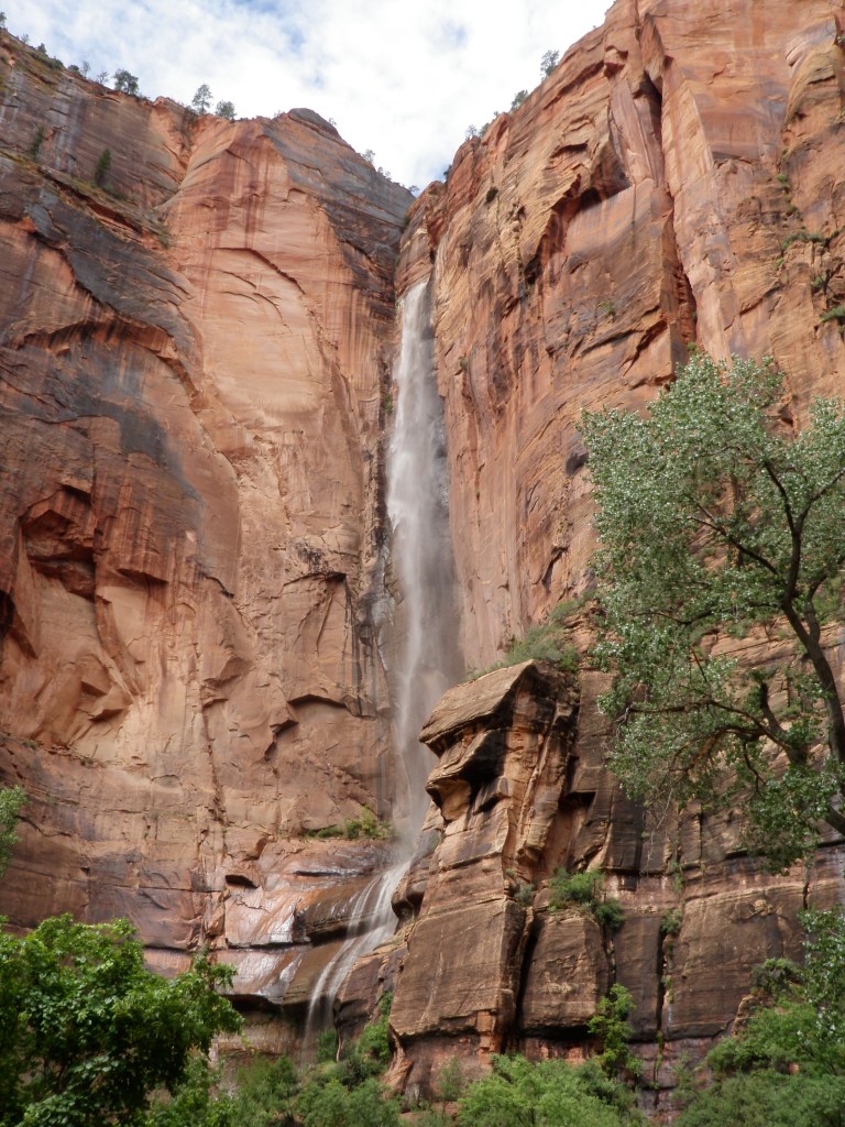
We begin our full day exploration by making our way (either on e-bike or park shuttle) from the park entrance up Zion Canyon to the Temple of Sinawava (Stop #9), following the Virgin River as it winds through the valley and the canyon walls gradually rise around us. As we move deeper into the canyon, the scale becomes more pronounced—sheer sandstone cliffs, shifting light, and the steady presence of the river all contribute to a strong sense of arrival. Along the way, notice how the canyon opens and closes in different stretches, revealing wide views in some places and tighter formations in others. This stretch covers roughly 8.5–9 miles one way with a gradual elevation gain of about 400–500 feet. Allow about 30–60 minutes to reach the upper canyon, depending on shuttle timing and potential lines to board.
Riverside Walk and the Narrows Entrance
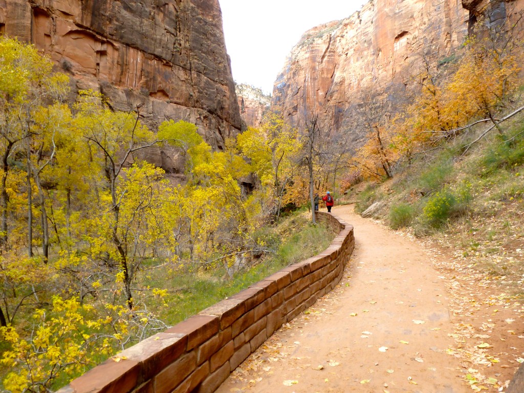
Once we reach the Temple of Sinawava (Stop #9), we look for signs directing us to the Riverside Walk and the Narrows Entrance, located just beyond the shuttle turnaround. From here, we begin the Riverside Walk, an easy, mostly flat path that follows the Virgin River as the canyon begins to narrow. This is one of the most accessible and rewarding walks in Zion, with sheer sandstone walls rising on both sides and the river always close at hand. The trail continues to the entrance of the Narrows, where the path gives way to the river itself. Even without continuing further, this point provides a clear sense of Zion’s scale and geology. This walk covers up to 2 miles round trip with minimal elevation gain of about 100–150 feet. Allow about 60–90 minutes at a comfortable pace, including time to pause and take in the surroundings.
Angels Landing & The Narrows
Two of Zion’s most well-known hikes—Angels Landing and the Narrows—offer some of the park’s most memorable and dramatic experiences, but they also require a higher level of preparation. Both involve advance planning, whether securing permits, arranging proper footwear, or preparing for more strenuous conditions and exposure. With limited time in the park, we chose instead to focus on shorter, more accessible walks that allowed us to experience the canyon at a relaxed pace. This approach still provided a strong sense of Zion’s scale, variety, and changing landscape, while maintaining flexibility throughout the day. For those interested in exploring further, brief descriptions of these more challenging hikes are included below.
Angels Landing
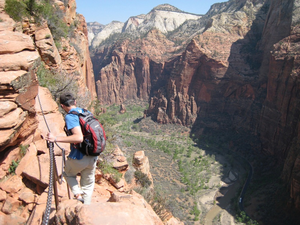
Angels Landing is one of Zion’s most well-known hikes, offering expansive views from high above the canyon, but it also requires careful planning and a comfort level with steep, exposed terrain. The full hike is approximately 5.4 miles round trip with about 1,500 feet of elevation gain, typically taking 3–5 hours to complete. The route begins on a well-defined trail and climbs steadily through a series of switchbacks, including the section known as Walter’s Wiggles, before reaching Scout Lookout. This portion—about 2 miles one way with roughly 1,000 feet of elevation gain—does not require a permit and provides excellent views, making it a worthwhile destination on its own.
From Scout Lookout, the final stretch to Angels Landing becomes significantly more challenging and requires a permit obtained in advance through a lottery system. This section follows a narrow ridgeline with steep drop-offs on both sides and includes chain-assisted sections for stability. While the full hike is highly rewarding, it demands time, preparation, and a steady pace, and may not be suitable for all visitors.
The Narrows
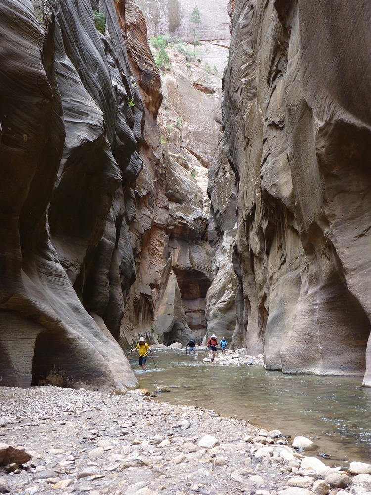
The Narrows offers a very different kind of experience, allowing you to walk directly through the Virgin River as the canyon walls close in around you. Beginning at the end of the Riverside Walk, this hike has no defined trail—just the river itself. Many visitors choose to explore a short section before turning back, while more experienced hikers may continue for several miles. A typical out-and-back hike can range from 2 to 6 miles round trip, with minimal elevation change, and can take anywhere from 2 to 6 hours depending on distance and conditions.
This hike requires preparation, including proper footwear for walking in water, a walking stick for balance, and attention to current weather conditions. Flash floods are a real risk in narrow canyon sections, so checking forecasts and park advisories is essential before entering the river. The effort is rewarded with a unique and immersive experience, where towering canyon walls, reflected light, and the sound of flowing water define the landscape.
Big Bend Viewpoint (Shuttle Stop #8)
After returning from the Riverside Walk, we continue down the canyon to Big Bend (Stop #8), one of the widest and most open viewpoints in Zion. Here, the Virgin River curves through the valley floor while the canyon walls rise sharply on all sides, offering a clear and balanced view of the surrounding formations. It’s an optional, stop that requires very little effort and is easy to access directly from the shuttle stop, making it a great place to appreciate the scale of Zion without committing to a longer hike. This involves minimal walking with no meaningful elevation change. Allow about 5–10 minutes to stop, take in the view, and continue on.
Weeping Rock (Shuttle Stop #7)
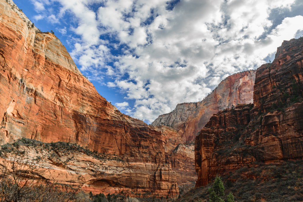
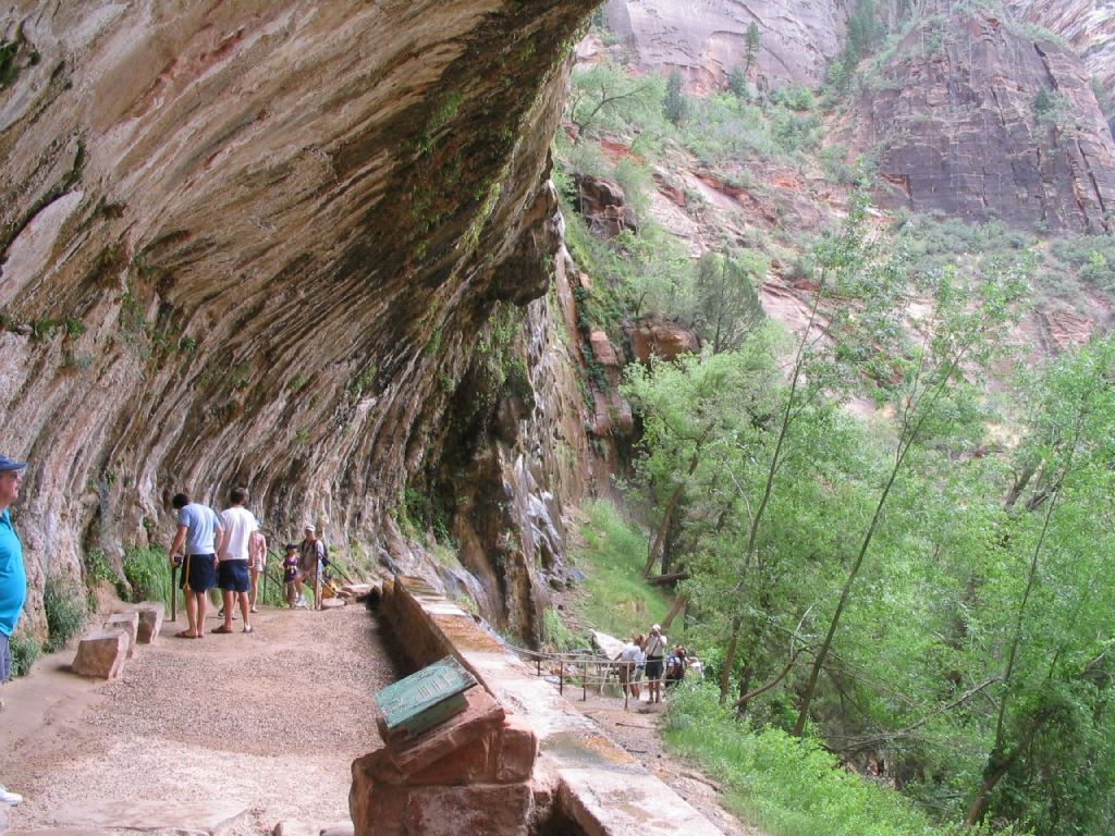
As we continue down the canyon, we make our way to Weeping Rock (Stop #7) and look for the short, clearly marked trail just beyond the shuttle drop-off. From here, a brief but slightly uphill walk leads to a shaded alcove tucked into the canyon wall, where water seeps through the sandstone and supports hanging vegetation above us. The change in temperature, light, and moisture creates a cool, enclosed space that contrasts sharply with the surrounding canyon. This is an out-and-back walk of about 0.4 miles round trip with roughly 100 feet of elevation gain, returning us to the same starting point. Allow about 10–15 minutes to reach the alcove and take in the setting before continuing down the canyon. (Note: this trail is occasionally closed due to rockfall conditions.)
Zion Lodge and Break Stop (Shuttle Stop #5)
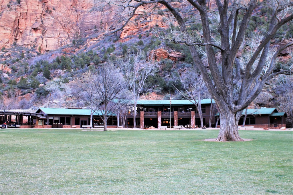
From Weeping Rock, we continue down the canyon toward the Zion Lodge area (Stop #5), either by biking directly along the canyon road or by boarding the shuttle at Stop #7. Both options follow the same route down the canyon and bring us to the lodge area, where we pause for lunch, rest, and recharge. Here, we can take advantage of restrooms, refill water, and either grab something to eat or enjoy a simple picnic. The open lawn and surrounding canyon views make it a comfortable place to take a longer break before heading out on the next walk.
Grotto and Emerald Pools Trails
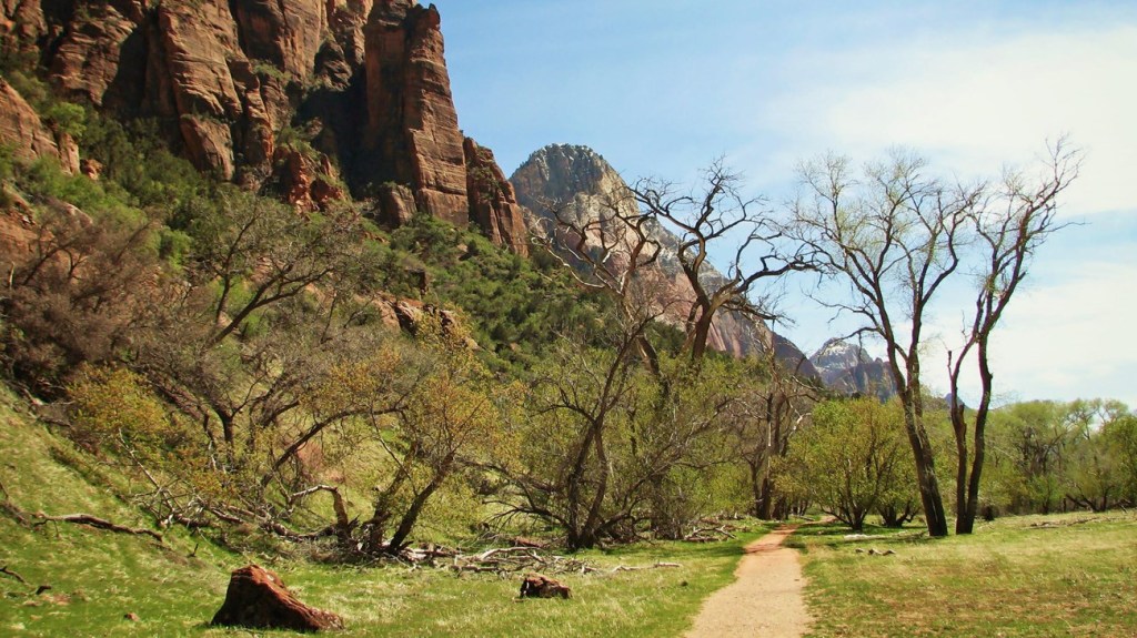
After our break at the lodge, we begin our main walk of the day walk from the Zion Lodge area (Stop #5), following the flat Grotto Trail along the river toward The Grotto (Stop #6). From there, we cross the road and pick up the Kayenta Trail, which climbs gradually above the canyon floor, offering open views as we make our way toward the Upper Emerald Pool at the base of a cliff. The “pools” themselves are small, water-fed basins formed by runoff seeping through the sandstone, collecting at different levels along the trail. While water flow varies by season, they often appear as shallow, green-tinged pools surrounded by rock and vegetation. After visiting the Upper Pool, we descend past the Middle and Lower Pools, where shaded alcoves and seasonal waterfalls provide a cooler contrast to the exposed canyon walls. The trail then leads back toward the lodge area, completing a natural and continuous loop. This walk covers approximately 2.5–3 miles with an elevation gain of about 500–600 feet. Allow about 1.5–2.5 hours to complete the full route at a comfortable pace, including time to pause along the way.
Remain in the Canyon or Return to the Visitor Center
At this point in the day, we have the flexibility to decide how we want to finish. Depending on time, energy level, and interest, we can choose to remain in the canyon a bit longer—revisiting a favorite spot, taking an additional short walk, or pausing at one of the viewpoints along the way. As we make our way down the canyon, we’ll pass by Court of the Patriarchs (Stop #4), an easy viewpoint with a short walk that frames three prominent peaks above the valley floor, and farther along, the Zion Human History Museum (Stop #2), which offers exhibits and a broad viewing terrace overlooking the canyon. Alternatively, we can continue toward the Visitor Center (Stop #1), either by biking or using the shuttle. As we exit the canyon, the landscape gradually opens and the towering walls begin to recede, offering a different perspective on places we’ve already seen. Whether we continue exploring or head back, this final stretch provides a natural opportunity to reflect on the full range of the day.
Dining in Springdale
After our day in the canyon, Springdale offers several good options for a relaxed dinner. Oscar’s Café is a popular choice, known for generous portions of Southwestern dishes, burgers, and tacos, with outdoor seating and views of the surrounding red rock. Zion Canyon Brew Pub offers a convenient and casual setting near the park entrance, with solid pub food and house-brewed beers—an easy option after a day of exploring. For something with a bit more personality, Bit & Spur Restaurant & Saloon serves Southwestern and Mexican-inspired dishes in a lively setting, well known for its margaritas. Whiptail Grill, set in a converted gas station, offers fresh, creative Mexican dishes in a casual but slightly more refined environment. Together, these spots give us a range of easy, enjoyable choices to end the day.
Thanks for exploring with me!
Thanks for exploring Zion with me. I hope this experiecnce in the canyon gave you a good sense of its scale, variety, and rhythm—from quiet riverside paths to elevated views and changing light throughout the day. Whether you followed this plan closely or made it your own along the way, Zion has a way of staying with you. Safe travels as you continue your journey, and I look forward to walking—or rambling—together again.
If you enjoyed the route, found a hidden gem, or have ideas for improving the experience, I’d love to hear from you! Your insights help me improve future experiences and inspire fellow travelers. Please rate this walk using the stars below — and feel free to leave a comment. Thank you! — and happy exploring!


Click here for more JCV Walks & Rambles
Your journey doesn’t have to end here. Choose another experience and let’s keep exploring together—one step (or mile) at a time.
Bryce Canyon National Park
Walk the rim and descend among Bryce’s iconic hoodoos, where sculpted rock formations rise in vivid colors from the canyon floor. A mix of easy viewpoints and immersive trails offers a close-up experience of one of the Southwest’s most distinctive landscapes.ption
Scenic Byway 12 and Capitol Reef
Follow one of Utah’s most scenic roads as it winds across ridgelines, through red rock country, and over high mountain terrain before descending into Capitol Reef. A mix of short walks, viewpoints, and an easygoing park experience, where the landscape unfolds gradually rather than around a single landmark.
Hanksville to Blanding (UT-95 Scenic Drive)
Description
Photo Credits
- Zion National Park Three Patriarchs. By LeavXC, CC BY-SA 3.0,
- America the Beautiful Pass
- Zion Park Visitors Center NPS
- Pa’rus Trail Walk
- Temple of Sinawava, Public Domain
- Riverside Walk to the Narrows. By Phil Whitehouse. CC BY 2.0,
- Angels Landing (NPS)
- The Narrows (NPS)
- Big Bend Viewpoint. By Terry Dott, CC BY 2.0,
- Weeping Rock. By Ken Lund, CC BY-SA 2.0,
- Zion NP Lodge By Richard Mouser – Own work, CC BY-SA 4.0,
- The Grotto Trail. By Don Graham, CC BY-SA 2.0,
- Emerald Pools Trail. By Phil Whitehouse, CC BY 2.0,
- Zion Shuttle (NPS)
