Scenic Byway 12 and the Capitol Reef Experience

This journey is defined by the experience of Scenic Byway 12 and the distinctive character of Capitol Reef, combining one of Utah’s most celebrated drives with one of its more understated national parks. Unlike Zion’s National Park’s enclosed canyon immersion or Bryce Canyon’s concentrated formations, this day unfolds as a progression—moving through a wide range of terrain that shifts continuously in color, elevation, and scale. Highway 12 carries you through open red rock country, across exposed ridgelines, and into higher elevation forests before descending toward Capitol Reef, where the landscape transitions once again. Here, the experience becomes quieter and more relaxed, shaped less by a single landmark and more by the subtle interplay of cliffs, orchards, and valley floor. Together, the drive and destination create a balanced day that emphasizes movement, variation, and a gradual deepening connection to the landscape.
Bryce Canyon to Capitol Reef
The drive from Bryce Canyon to Capitol Reef is anchored by Scenic Byway 12, widely regarded as one of the most scenic roads in the country. Beginning in the cooler, forested elevations near Bryce, the route quickly opens into the layered canyon environments near Escalante, where red rock formations and expansive vistas define the terrain. The road climbs dramatically along the Hogback, offering narrow ridgeline driving with sweeping views in all directions, before transitioning again as it rises into the higher elevations of Boulder Mountain. From there, the descent toward Torrey introduces one final shift, as cooler forest gives way to the warmer tones and wider valleys near Capitol Reef. Entering the park, the experience changes from driving through to moving within the landscape—where cliffs, orchards, and the Fremont River create a more grounded and intimate setting. This is a day shaped by variation rather than a single highlight, where Highway 12 provides the progression and Capitol Reef provides the place to slow down and explore.

Depart Bryce Canyon (UT‑63 → UT‑12 East)
As a optional, final moment in Bryce Canyon National Park before setting off on the next phase of our journey, Sunrise Point offers a quiet and fitting sendoff. From Bryce Canyon Lodge, it’s an easy 0.5-mile walk along a flat, well-marked path.
Before leaving the Bryce area, it’s a good idea to top off fuel and water, as services become more limited along the route. Depart the Bryce Canyon area on UT‑63, then turn right towards Escalante on Scenic Byway 12, one of America’s most scenic roads. As we begin our transition out of Bryce, almost immediately the landscape begins to shift. The dense ponderosa forest that surrounds the park gradually opens, revealing more distant views and brighter tones of red and ochre. Scenic Highway 12 earns its reputation early—you’ll notice how the terrain stretches wider, less enclosed, hinting at the expansive desert landscapes ahead. The road gently winds through higher elevation plateaus before beginning its descent into more rugged country.
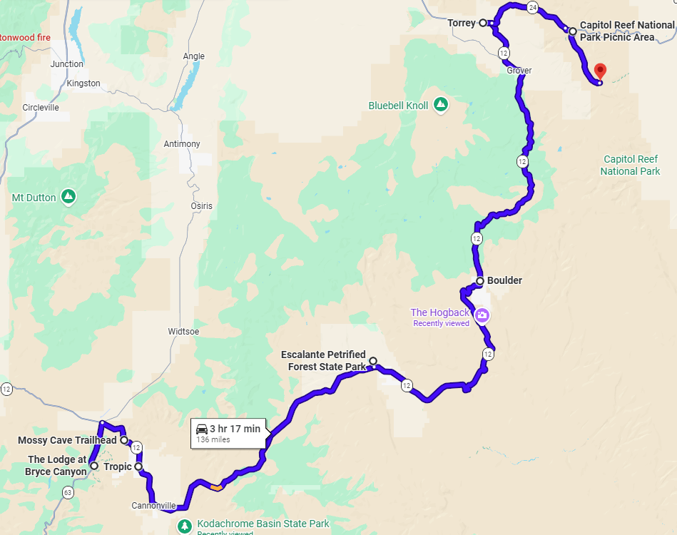
Mossy Cave Trailhead
As you begin the day’s journey, watch for the signed Mossy Cave Trailhead shortly ahead. A small roadside parking area provides easy access. This short out-and-back hike covers approximately 0.8 miles round trip with about 100–150 feet of elevation change, and takes 20–30 minutes. The trail begins with a gentle descent toward a small stream, then splits—one direction leads to a modest waterfall, while the other climbs gradually to Mossy Cave. This is a quick, optional stretch of the legs before the longer drive. The combination of water, rock formations, and close-up hoodoo views offers a different perspective from the rim—compact, varied, and easy to access without adding much time to your day.
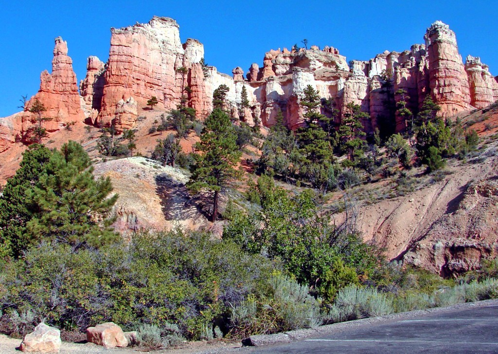
Town of Tropic
Continue east on UT‑12, passing through the small town of Tropic shortly after leaving Bryce Canyon. It is a quiet, rural community with open views toward the surrounding plateaus. As you drive through, you may notice a few local establishments, historic buildings, and wide stretches of farmland that reflect the area’s agricultural roots. It’s a subtle but meaningful transition point—one of the last glimpses of Bryce’s higher elevation before the landscape begins to open into the broader red rock country ahead.
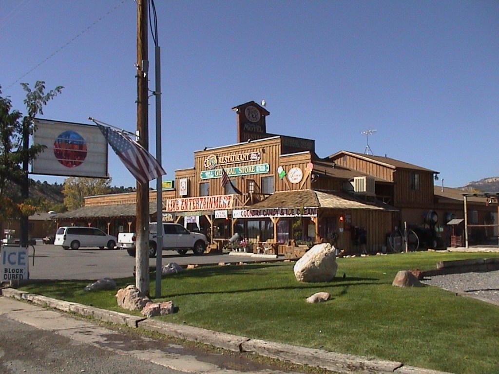
Cannonville
Cannonville is a quiet rural town along Scenic Highway 12 that serves as the gateway to nearby destinations such as Kodachrome Basin State Park and access points into the vast Grand Staircase–Escalante National Monument. With open farmland, low-key services, and wide views of surrounding plateaus, it offers a subtle transition from Bryce’s higher elevations into the broader red rock landscape that defines the region ahead.
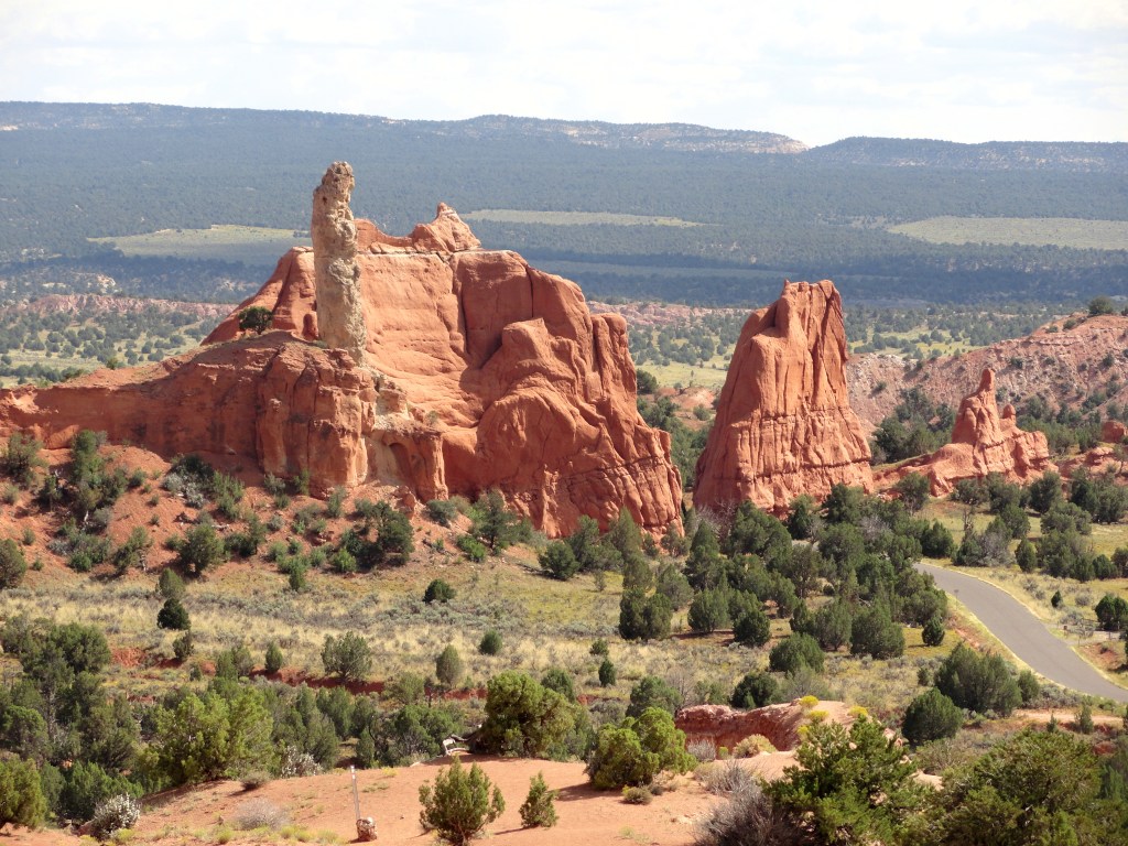
Kodachrome Basin State Park (Optional Detour)
Located just south of Cannonville, Kodachrome Basin State Park is a lesser-visited state park is known for its striking sandstone spires—often called “chimneys”—that rise from a colorful desert basin. The setting is quiet and expansive, offering a different visual experience from Bryce, with soft layers of red, orange, and white rock and easy access to short hikes and scenic viewpoints. To reach the park, turn off Scenic Highway 12 at Cannonville and follow a paved road for approximately 7–9 miles each way. If you take this detour, expect to add about 15–20 miles round trip and 30–40 minutes of drive time to your day, plus any additional time spent exploring inside the park.
Escalante Petrified Forest State Park (Optional Detour)
Continue on UT‑12 as you approach Escalante; the entrance to the Escalante Petrified Forest State Park is just off the highway. This area is known for its scattered deposits of colorful petrified wood, visible across low hills above Wide Hollow Reservoir. If you choose to explore, there is a day-use fee (typically around $10–$15 per vehicle). The most popular option is the Rainbow Loop Trail, a 1.5‑mile loop with moderate elevation gain (about 200–300 feet) and an estimated hiking time of 45–75 minutes. The trail includes a few steeper sections but is manageable for most visitors and offers broader access to petrified wood than the shorter main trail.
Town of Escalante
Continue east on UT‑12 as you pass through the town of Escalante, roughly midway between Bryce Canyon and Capitol Reef. Escalante is a small, functional town that serves as a gateway to the Grand Staircase–Escalante region. As you drive through, you’ll notice a handful of gas stations, cafés, outfitters, and lodging options that support travelers exploring the surrounding canyons and backcountry. Compared to Bryce, the setting feels more open and remote, with lower elevations and broader views of the surrounding terrain. It’s a natural waypoint to take on fuel, grab a quick snack, or simply pass through as the landscape begins to shift more noticeably into canyon country.
Hole‑in‑the‑Rock Wayside
Continue east on UT‑12 and watch for the signed Hole‑in‑the‑Rock Wayside. This small roadside stop marks the historic route taken by Mormon pioneers who carved a passage through the canyon country to reach the Colorado River. Today, it serves primarily as the starting point for the long Hole‑in‑the‑Rock Road into Grand Staircase–Escalante. There are open views of the surrounding terrain, but the significance here is more historical than scenic, and most travelers continue without stopping unless interested in the route’s background.
Head of the Rocks Overlook
Continue east on UT‑12 just beyond Escalante and look for the signed turnout. This is one of the most expansive viewpoints along the drive and well worth a brief pullout. A short walk from the parking area opens to sweeping views over the Escalante River canyon system, where the landscape drops away into a maze of ridges, cliffs, and deep-cut canyons stretching far into the distance. The scale is immediate and striking, offering one of the clearest perspectives of the Grand Staircase–Escalante region. Even a few minutes here provides a strong sense of just how vast and layered this terrain truly is.
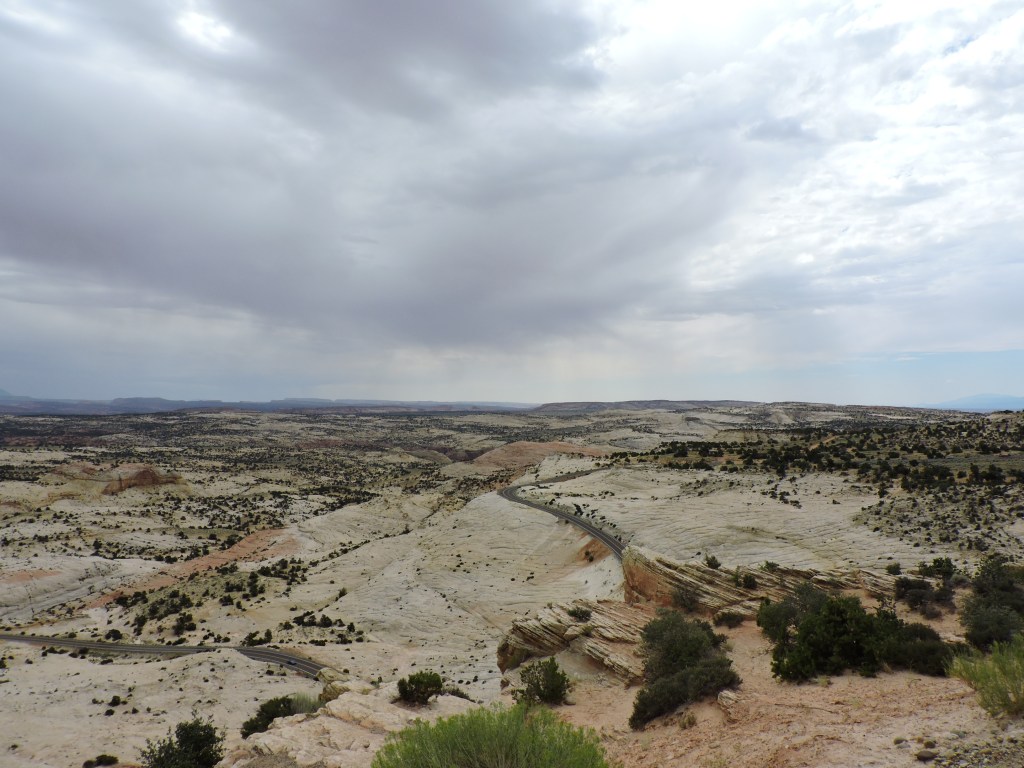
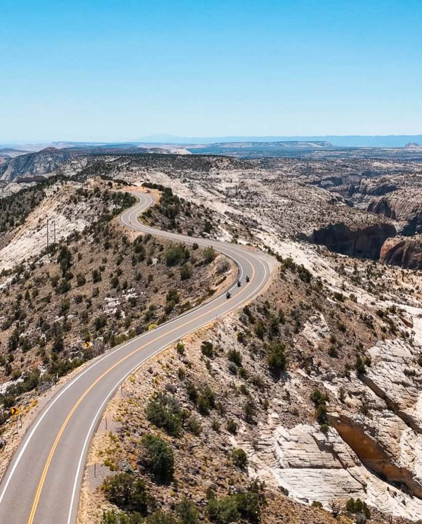
Boulder Mountain – Hogback Scenic Drive
Continue east on UT‑12 for approximately 20–25 miles, where the road climbs and narrows along the Hogback ridgeline. This section follows a narrow ridge with steep drop-offs on both sides, offering extended views across surrounding canyons and valleys. The road then climbs in elevation toward Boulder Mountain, where the landscape shifts to higher elevation terrain with forested areas, before descending again toward Torrey. The contrast between exposed ridgeline driving and the cooler, wooded environment at higher elevation highlights the range of terrain along this portion of UT‑12.
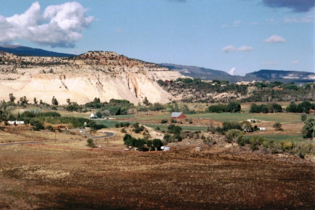
Boulder
Continue east on UT‑12 into the small town of Boulder, set at the base of Boulder Mountain. Boulder serves as a quiet midpoint along Scenic Byway 12 and an access point to some of the more remote parts of southern Utah. The town itself is small, with a handful of lodges, cafés, and locally known restaurants, including options that highlight regional and farm-to-table ingredients. It sits at the transition between higher elevation forest and the surrounding canyon country, making it a convenient base for those looking to explore beyond the main highway. For travelers with more time, Boulder provides access to nearby trails, slot canyons, and backroads within Grand Staircase–Escalante. It’s less about a specific stop and more about a place to slow the pace, regroup, or use as a base for deeper exploration of the surrounding landscape.
Additional Waypoints
Located in Boulder just off UT‑12. The Anasazi State Park & Museum preserves an ancient Ancestral Puebloan (Anasazi) site, including a partially excavated village and artifacts. It offers historical context rather than scenic views. Worth a stop if you’re interested in early inhabitants of the region; otherwise, it can be skipped on a drive-focused day.
Continue east on UT‑12 as you begin descending toward Torrey. This overlook opens toward Capitol Reef and the Henry Mountains in the distance. It provides a forward-looking view of where you’re heading, with broader vistas and clearer sightlines. Worth a brief stop for orientation and scenery before the descent into Torrey.
Continue east on UT‑12 along the ascent. This viewpoint looks out over lower valleys and rolling terrain below Boulder Mountain. The views are pleasant but more subtle than other overlooks. A short stop is optional, depending on interest and timing.
Continue east on UT‑12 as the elevation increases. This stop offers a clear view down into a narrow canyon cut below the highway, showing the vertical drop and layered rock formations. It’s a quick roadside stop that highlights the terrain change as you move higher onto Boulder Mountain.
Continue east on UT‑12, climbing toward Boulder Mountain. This overlook provides wide views back toward the Escalante region and surrounding valleys. The perspective opens quickly from the roadside, making it an easy and worthwhile stop if you want a brief look back across the terrain you’ve just traveled.
Torrey
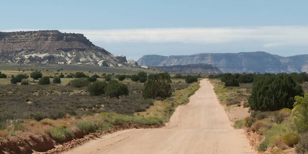
Continue east on UT‑12 as you descend from Boulder Mountain. At the junction with UT‑24, turn right to continue directly into Capitol Reef National Park. If you turn left, you’ll enter the town of Torrey. Torrey serves as a convenient gateway town, offering a range of lodging, casual dining, and basic services in a quiet, laid-back setting. It’s a good place to pause and regroup before entering the park, or to base yourself if you’re planning a deeper visit to Capitol Reef. For those considering an overnight stay, Torrey provides the most accessible accommodations near the park without staying inside it. If you choose to stop, the Chuck Wagon General Store is well worth a quick visit. It’s an unusually well-stocked small-town store, offering deli items, snacks, camping supplies, refrigerated goods, hats, and basic over-the-counter essentials—all in one place. There’s even a laundromat attached, making it a practical and reliable stop before continuing your journey.
Capitol Reef National Park
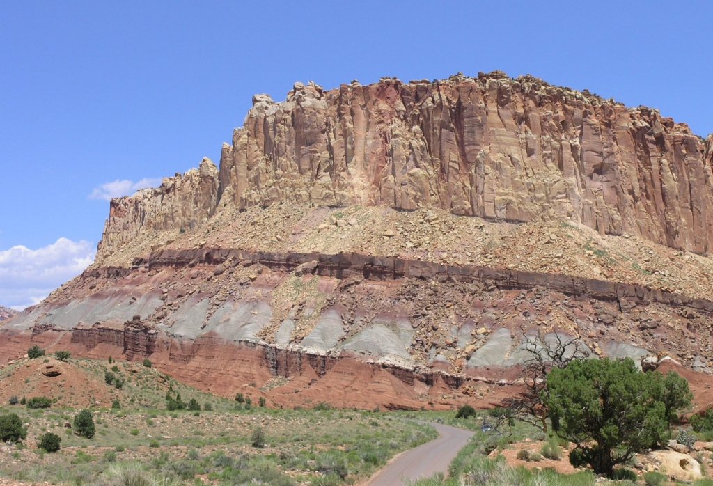
From Torrey, take UT‑24 East and continue into Capitol Reef National Park. Capitol Reef is defined by the Waterpocket Fold, a nearly 100‑mile geologic uplift that shapes the park’s cliffs, domes, and ridgelines. Unlike other Utah parks that concentrate views around major landmarks, Capitol Reef is experienced more gradually, with the landscape unfolding along the road. Layers of rock, long escarpments, and narrow valleys create a continuous sense of structure rather than a single focal point.
Compared to parks like Zion or Bryce Canyon, Capitol Reef is typically quieter, with fewer developed overlooks and a greater sense of space. Its scale feels more horizontal than vertical, and the experience is more about movement through the landscape than arriving at a single viewpoint. This gives the park a more understated and less crowded character within Utah’s canyon country.
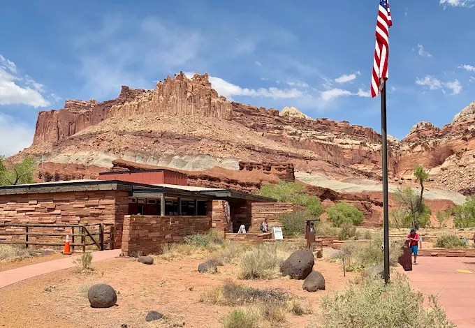
Capitol Reef National Park Visitors Center
Continue east on UT‑24 into Capitol Reef. The Visitor Center is located just a few miles inside the park and is clearly signed, with parking available on-site. This is a good place to make a brief stop to get oriented before continuing through the park. Inside, you’ll find maps, exhibits, and current information on road conditions, trail options, and ranger programs. It’s especially helpful if you’re considering additional stops or short hikes, as conditions can vary by season. Even a quick visit provides useful context for understanding the park’s layout, geology, and key points of interest before resuming your drive.
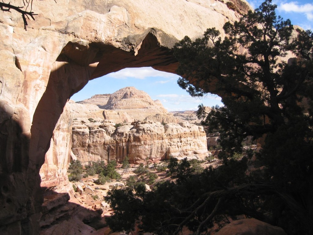
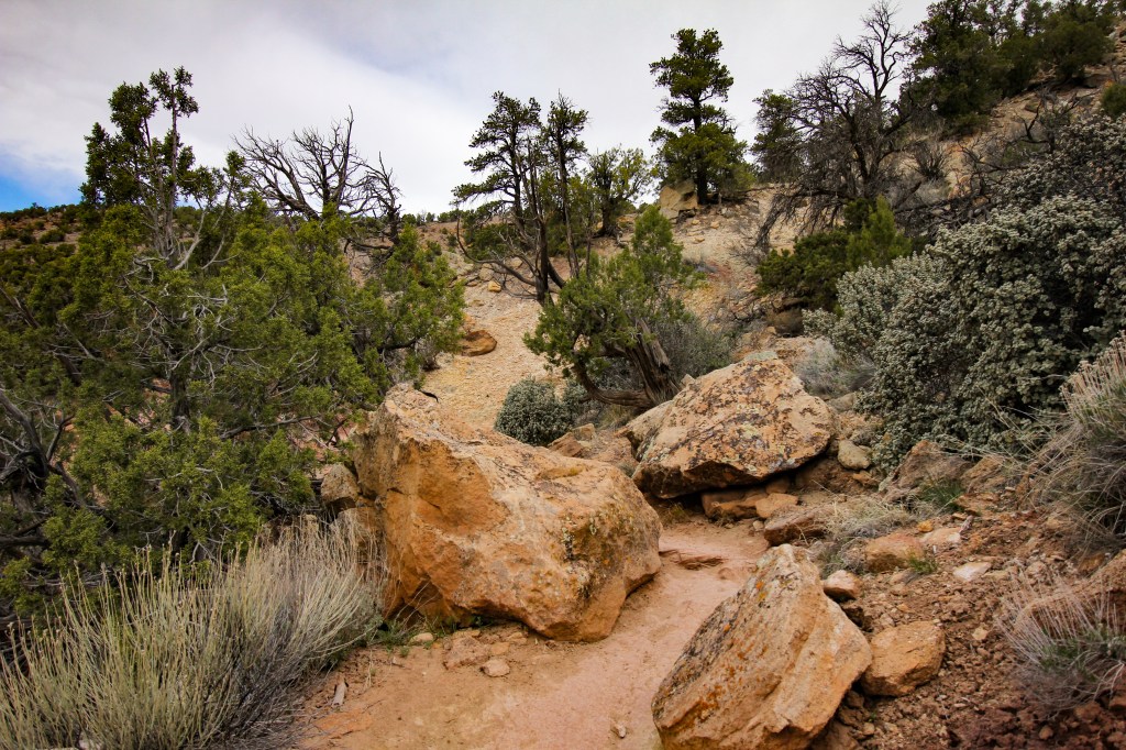
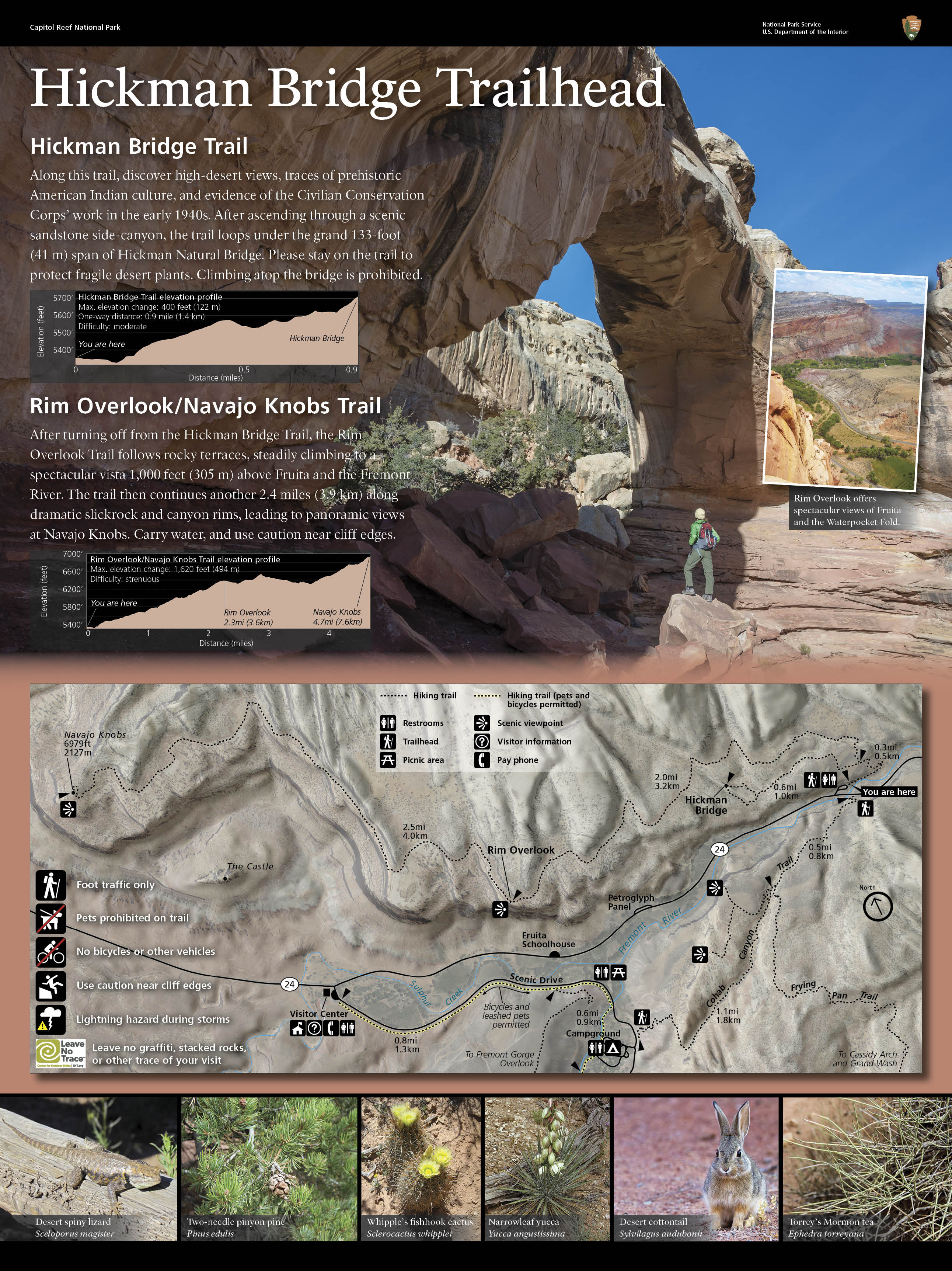
Hickman Bridge Trail
From the Visitor Center, continue east on UT‑24 for a short distance and look for the clearly signed Hickman Bridge Trailhead with parking available on the right. This is one of the most rewarding and efficient hikes in Capitol Reef, offering a deeper look into the park’s geology without requiring a significant time commitment. The trail begins with a steady but manageable climb, gaining elevation gradually as views open across the surrounding cliffs and rock formations. Along the way, you’ll pass layered sandstone, shallow washes, and natural viewpoints that provide perspective on the Waterpocket Fold. After roughly one mile, the trail leads to Hickman Bridge—a large natural sandstone arch spanning the canyon below, where it’s worth pausing to take in both the formation and the broader landscape. This walk covers approximately 1.8 miles round trip with an elevation gain of about 400 feet. Allow about 1 to 1.25 hours to complete the full route at a comfortable pace, including time to pause along the way. Extending to the Rim Overlook increases the distance to roughly 4.5 miles round trip and 2 to 3 hours, while the full Navajo Knobs hike reaches about 9 miles round trip and can take 4 to 6 hours in total.
Fruita Picnic Area
After completing the hike, return a short distance west on UT‑24 toward Capitol Reef Scenic Drive toward the Fruita Picnic Area, where you can park and explore on foot.
We’ll use the picnic area as our base for a relaxed stop in one of the most inviting and walkable pockets of Capitol Reef. Large shade trees and the nearby Fremont River create a calm, almost pastoral setting—an ideal place to pause, enjoy lunch, and take in the contrast between greenery and the surrounding red rock cliffs. This is a place to slow down after the morning’s drive and appreciate a different side of the park, where human history and natural beauty intersect in a small, fertile valley.
Fruita District Exploration
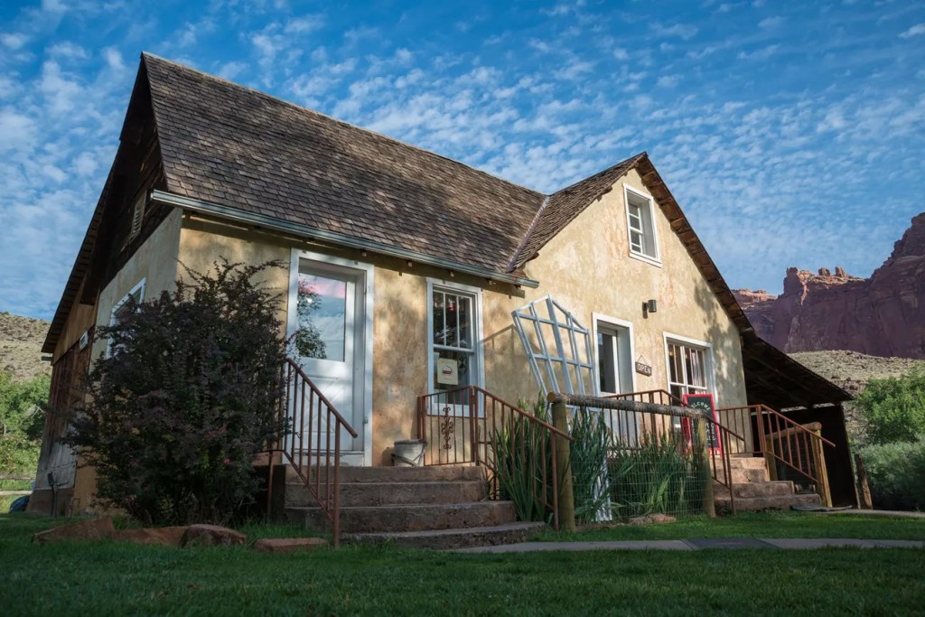
- Gifford Homestead (0.2 miles, ~4-minute walk)
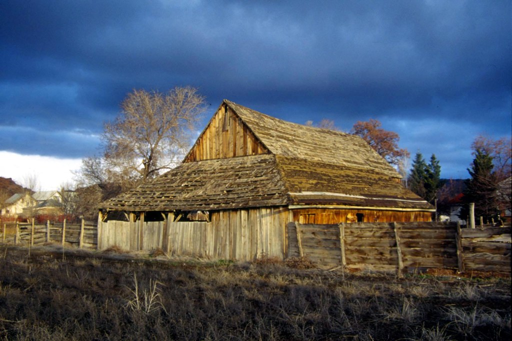
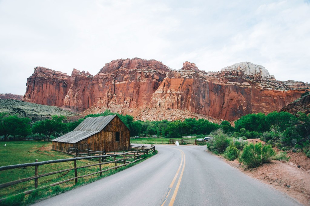
The Gifford farm lies in the heart of the Fruita valley, a desert oasis described by Wallace Stegner as “…a sudden, intensely green little valley among the cliffs of the Waterpocket Fold, opulent with cherries, peaches, and apples in season, inhabited by a few families who were about equally good Mormons and good frontiersmen and good farmers. The 200 acre Fruita Rural Historical District is listed on the National Register of Historic Places. - Fruita Barn and Orchards (adjacent to Homestead)
Just beyond the homestead, you’ll find the historic barn and surrounding orchards. Depending on the season, some orchards may be open for fruit picking, offering a unique opportunity to sample or purchase apples, peaches, or other heirloom varieties grown on-site. - Ripple Rock Nature Center (0.1–0.2 miles, ~2–3-minute walk)
A small, informal stop that provides helpful context on the geology and landscape of Capitol Reef. It’s quick to visit and adds depth to what you’re seeing throughout the park.
Capitol Reef Scenic Drive
From the Fruita area, continue onto the signed Capitol Reef Scenic Drive, a paved road that extends approximately 8 miles south into a quieter and less-traveled section of the park. This is an out-and-back journey, so plan for about 16 miles round trip, allowing roughly 60-90 minutes with a few short stops. The value of this drive is in how it shifts your perspective—from viewing the Waterpocket Fold from a distance to moving within it. As the road narrows, cliffs rise more closely on either side, and the landscape feels more contained and immersive. Compared to the broader views along UT‑24, this section offers a more intimate experience of Capitol Reef’s geology, with layered rock walls, subtle color changes, and a greater sense of scale from within the formation itself.
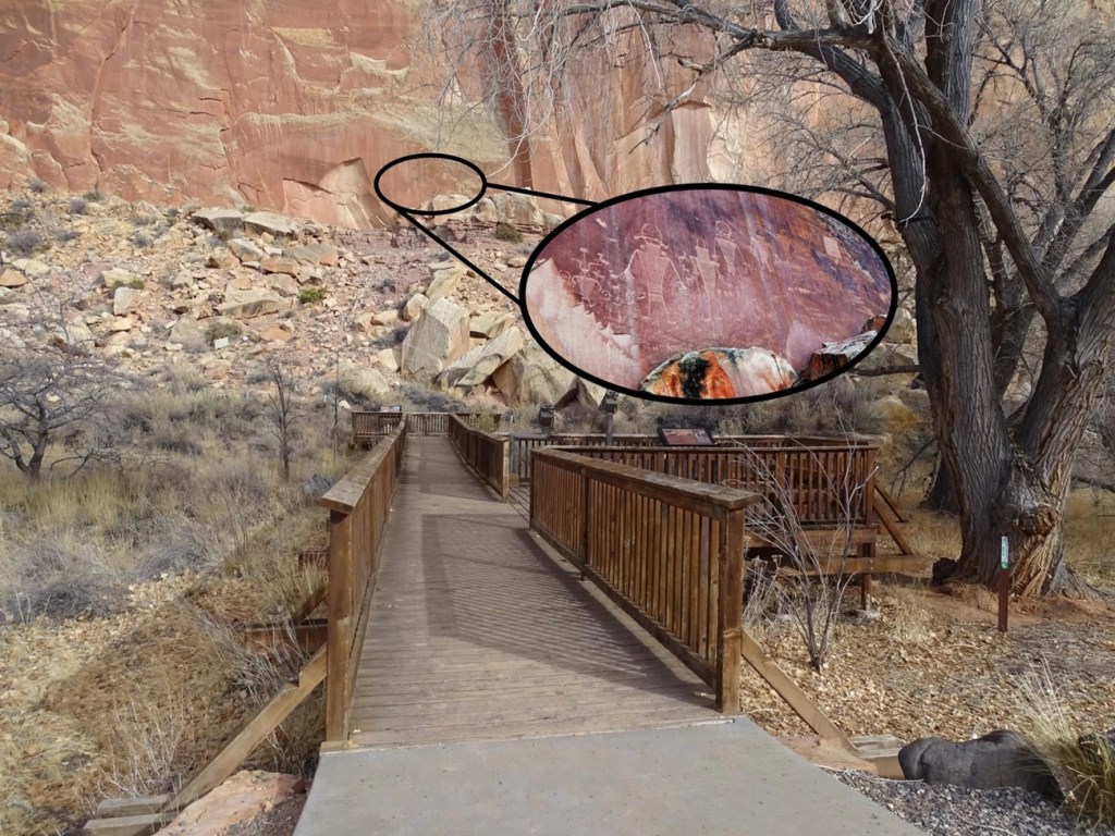
Petroglyph Panels Boardwalk
After completing the Scenic Drive, return to UT-24 and turn right to head east a short distance. Ahead on the left is a turnout and parking lot for the Petroglyph Boardwalk. We’ll take a short walk along a wooden boardwalk that runs parallel to the cliff face. Within just a few minutes, ancient petroglyphs come into view—carvings left by the Fremont culture over 1,000 years ago. The walk is brief and accessible, but the experience is meaningful. These markings offer a direct connection to the people who once lived in this landscape, adding depth beyond geology. As you move along the boardwalk, take your time noticing the details—the shapes, patterns, and placement on the rock. It’s a quiet, contemplative stop, and one that requires only a small investment of time for a unique and memorable perspective.
If you have more time to explore Capitol Reef
If you’re planning to spend a full or half day in Capitol Reef rather than passing through, there are several worthwhile hikes and scenic stops that showcase the park’s range:
- Chimney Rock Loop Trail (3.3 miles, ~600+ ft gain, 1.5–2 hours)
A moderate loop with a steady climb to a ridge, followed by wide views across the surrounding cliffs and valleys. One of the more varied hikes in the park, combining elevation, open ridgeline walking, and changing perspectives. Awesome moderate hike. I think it’s in the top five in national Park hikes in the country. Do the entire loop. There is a variety of scenery along the way. Great parking lot to leave vehicle. Wow, what a great 3 mile hike. Has some good climbing at the 1st about 625 ft to the top of the Mesa. Then you walk the ridge and get amazing views. I think I saw people in ages from 6-60s. The 1st 1 miles is pretty steep and is made up of steps and switchbacks. - Goosenecks Overlook. Continue east on UT‑24 for approximately 1 mile. Turn onto the signed dirt road for Goosenecks Overlook and drive a short distance to the parking area. A brief walk from the parking area brings you to the rim, where the view looks down onto tight, winding bends of the river far below. The canyon forms a series of compact, looping curves, showing how the river has gradually carved through the rock layers over time. This stop offers a more focused, close-range perspective compared to the broader valley views seen elsewhere in the park. Distance ~0.1–0.2 miles round trip, minimal elevation change, time ~10–15 minutes.
- The Fluted Wall (roadside / short stop)
An easily accessible rock formation visible from UT‑24, known for its vertical grooves and textured appearance—worth noting as you pass through. - Grand Wash & Cohab Canyon (varied distances)
Shorter canyon hikes that provide a closer look at the park’s narrow passages and layered rock walls, with options to extend or keep it brief.
Optional Sunset Return to Fruita
For those with the time and interest, consider returning to the Fruita area for sunset after completing the Petroglyph Panels Boardwalk. Rather than heading directly to your lodging in Torrey, a short drive back west on UT‑24 brings you once again into the orchard-lined valley, where the late-day light provides a quieter and more reflective close to your time in Capitol Reef. As the sun lowers, the surrounding cliffs take on warmer tones and long shadows stretch across the open fields, softening the landscape and creating a more intimate atmosphere than earlier in the day. There is no need to seek out a specific viewpoint—simply finding a comfortable spot near the orchard or along the roadside is enough. After sunset, it’s an easy 10–15 minute drive to Torrey to check in for the evening.

Click here for more JCV Walks & Rambles
Your journey doesn’t have to end here. Choose another experience and let’s keep exploring together—one step (or mile) at a time.
Zion National Park
Experience the canyon from within along riverside trails and scenic paths beneath towering sandstone walls. A balanced mix of easy walks and striking views, with an option to explore by bike or shuttle.
Bryce Canyon National Park
Walk the rim and descend among Bryce’s iconic hoodoos, where sculpted rock formations rise in vivid colors from the canyon floor. A mix of easy viewpoints and immersive trails offers a close-up experience of one of the Southwest’s most distinctive landscapes.ption
Scenic Byway 95 – Hanksville to Blanding
Coming Soon
Photo Credits
- Capitol Reef National Park By Wolfgang Staudt CC BY 2.0
- Sunrise Point By King of Hearts – Own work, CC BY-SA 4.0
- Utah State Route 12 By DXR – Own work, CC BY-SA 3.0
- Mossy Cave Trailhead By Don Graham CC BY-SA 2.0
- Town of Tropic by byways.org
- Cannonville By Bill Golladay – Own work, CC BY-SA 4.0
- Kodachrome Basin State Park By Fabio Achilli CC BY 2.0
- Henrieville Sign by Jacob Barlow
- Escalante Petrified Forest State Park By Mramoeba – Own work, CC BY-SA 4.0
- Town of Escalante By Scenic Byway 12 Steering Committee
- Hole in the Rock Wayside By G. Thomas Public Domain
- Head of the Rocks Overlook By halfuur, CC BY 3.0
- Calf Creek Overlook by Novobaczky Jozsef google Maps
- Hogback Scenic Drive by Ride to Food Facebook
- Boulder By byways.org
- Anasazi State Park By Nickeyrc – Own work, Public Domain
- Torrey By Byways.org
- Capitol Reef National Park By Karin Kim on unsplash
- Capitol Reef National Park Visitors Center by Dion Bok
- Hickman Bridge Trail By Bob Palin CC BY-SA 2.0
- Fruita Picnic Area by Tracy Zhang-QuRc5m4cBOs-unsplash
- Gifford Farm by Nathan Gross NPS
- Capitol Reef Scenic Drive CC BY-SA 2.5
- Petroglyph Panels Boardwalk by Ann Huston NPS
