A Remote Journey Across Southern Utah’s Canyon Country
The drive from Hanksville to Blanding stands apart from other southern Utah journeys—not because of a single landmark, but because of the openness and scale that define it. This is where the landscape becomes broader, quieter, and more remote, with long stretches of road and few interruptions. The scenery unfolds gradually: wide desert valleys, distant mountain ranges, and deep canyon systems carved into the plateau. It’s a setting that invites a slower pace, where the experience comes as much from the space between places as from the places themselves.
How to navigate with your mobile device
JCVWalks are designed to be easy to follow on your mobile device. As you travel from point to point, you can tap the header or photo for each point of interest to open the location directly in Google Maps. This will help you navigate from your current location to the next point of interest. If you’d like to learn more about any stop along the way, just click the links in the description for additional details and context.
This is a full day’s scenic drive that can begin either in Torrey or Hanksville, depending on where you choose to overnight after visiting Capitol Reef.
From Torrey, follow UT‑24 east for approximately 75–80 miles to Hanksville, where it’s worth taking time to refuel and reset before continuing.
If starting in Hanksville, you’ll begin directly on the next phase of the route. From here, turn south onto UT‑95 and continue for roughly 120 miles to Blanding.
Early in the drive, an optional detour to Factory Butte offers a noticeable shift in terrain, while farther along, Hog Springs and Hite Overlook provide well-placed opportunities to pause.
As the road descends toward the Colorado River, the landscape transitions from open plateau into deeper canyon before widening again beyond.
For those with more time, a detour to Natural Bridges National Monument adds a different perspective and a closer look at the region’s geology.
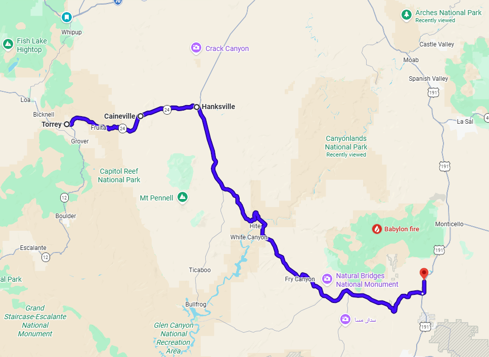
Plan for a full day of driving with a few optional stops and diversions . Blanding serves as a natural place to end the day and is a good choice if you plan to continue south toward Monument Valley the following morning. If your plans lean toward Canyonlands or Arches, it’s also possible to extend the day and continue north on US‑191 to Moab, though many travelers may prefer to overnight first after the length and pace of this drive.
UT‑24 toward Hanksville
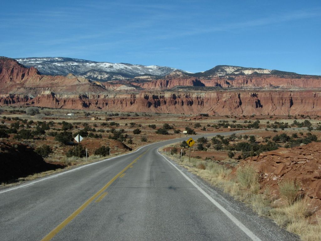
Depart Torrey heading east on UT‑24 toward Hanksville. As you leave town, the landscape continues briefly through the edges of Capitol Reef before transitioning more fully into open high desert. The shift is gradual but noticeable—the defined cliffs and cultivated valley give way to broader terrain with longer sightlines and fewer visual boundaries. As you continue east, the road straightens into extended stretches, and vegetation becomes sparse, with low desert brush replacing the greener tones behind you.
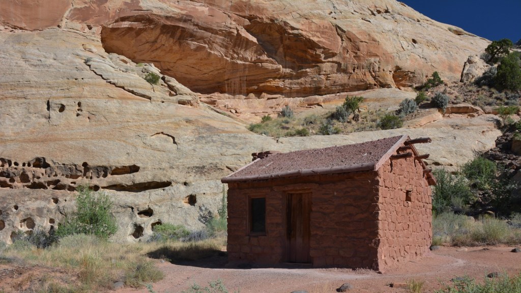
Behunin Cabin
Located just east of the Fruita area, the Elijah Cutler Behunin Cabin is a small, well-preserved log structure set against the red rock backdrop of Capitol Reef. Built in 1883-84, it offers a quiet glimpse into the lives of early settlers who made use of the narrow, fertile corridor along the Fremont River. A brief roadside stop provides context to the human history of the area without requiring much time away from the drive.
The Castle at Swingarm City
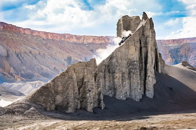
As you continue east on UT‑24, you’ll pass the turnoff for Swingarm City on the left, a large open riding area set within the Caineville badlands. No need to stop here unless interested. You will notice a castle-like structure in the distance, a recognizable landmark within the area where the landscape shifts from red rock to softer gray and tan terrain, formed into rounded ridges and shallow channels.
Caineville
As you pass through the small town of Caineville, the landscape becomes more open and less defined. This is a quiet stretch with little in the way of services or places to stop. Most travelers continue through, using it as a reference point as the drive moves away from Capitol Reef and into a more remote part of the route.
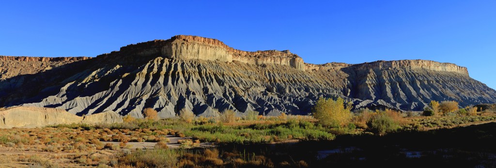
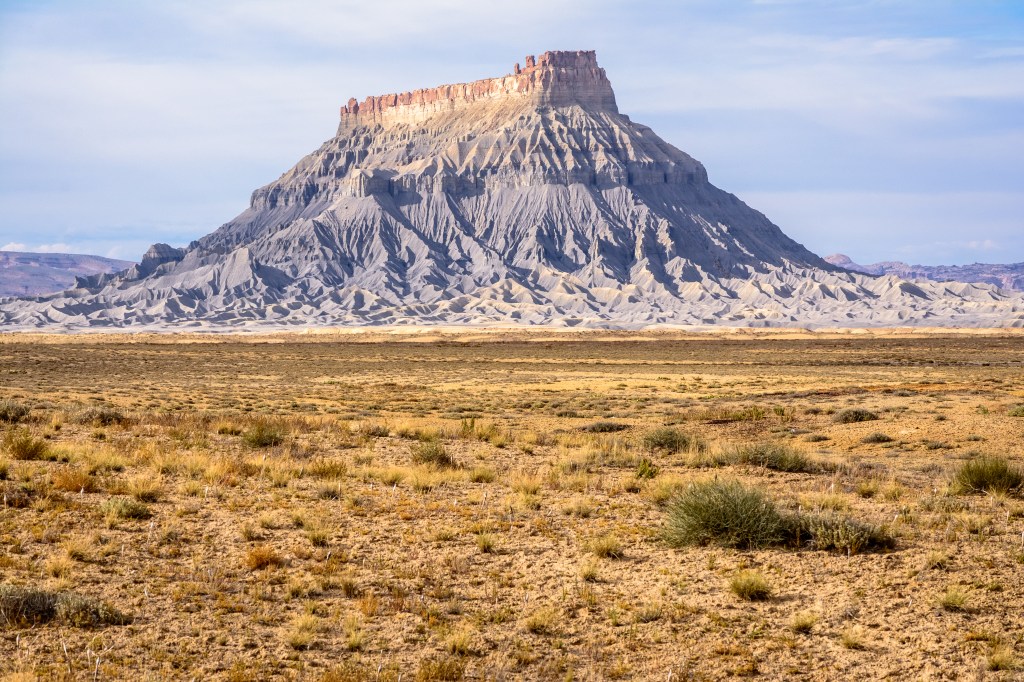
Factory Butte Overlook
About 5 miles before reaching Hanksville, watch for Factory Butte Road (signed, unpaved) on the left off UT‑24. Turn onto this road and drive a short distance—the surface is usually firm in dry conditions, and you don’t need to go far to get a good view. Factory Butte rises sharply from the desert floor, surrounded by soft gray badlands shaped into ripples and shallow gullies. The change in color and texture stands out from the red rock landscapes you’ve been traveling through. This is a quick, informal stop—10 to 15 minutes before continuing into Hanksville.
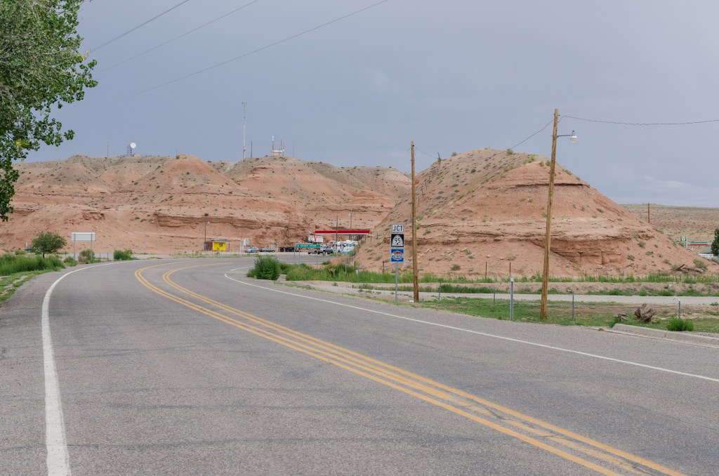
Hanksville
As you enter Hanksville, pull off along the main road where services are clustered, including gas stations and Stan’s Burger Shack. This is a practical but enjoyable stop and an important checkpoint in the day’s route. Take a few minutes to refuel both the car and yourself, and check fuel levels carefully before continuing, as the next segment to Blanding along UT‑95 runs roughly 120 miles with very limited services. A quick milkshake or snack feels well-earned after the morning and early afternoon on the road, and it’s a good opportunity to stretch and reset. Hanksville is small and unpretentious, but it serves an important role as the last reliable service stop before entering a longer, more remote stretch of highway.
UT‑95 Scenic Drive
From Hanksville, turn right onto UT State Route 95, Bicentennial HighwaySouth and continue for approximately 120 miles. This is one of the most remote stretches of the trip. There are few services, little development, and long sections of open road. The drive is less about stopping and more about taking in the scale of the landscape—distant mountain ranges, wide desert, and deep canyon systems that appear and recede as you move through the terrain. Cell service is limited to nonexistent, so this is a good time to put the phone away and look out the window.
Hog Springs Rest Area
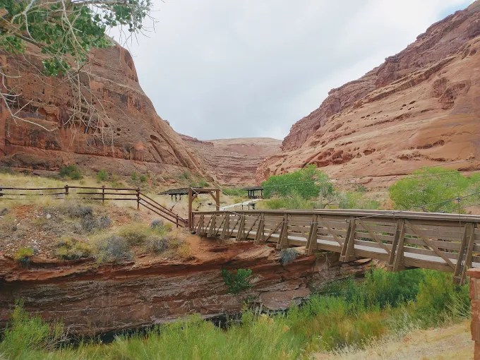
Continue on UT‑95 for about 20 miles south of Hanksville. Turn into the clearly marked Hog Springs Rest Area. This is a simple, functional stop, but a welcome one after the initial stretch of remote driving. A short break here allows you to reset—stretch your legs, take in the quiet, and prepare for the more dramatic scenery ahead. The setting is modest, with basic facilities and a few picnic tables, but the surrounding landscape remains expansive.
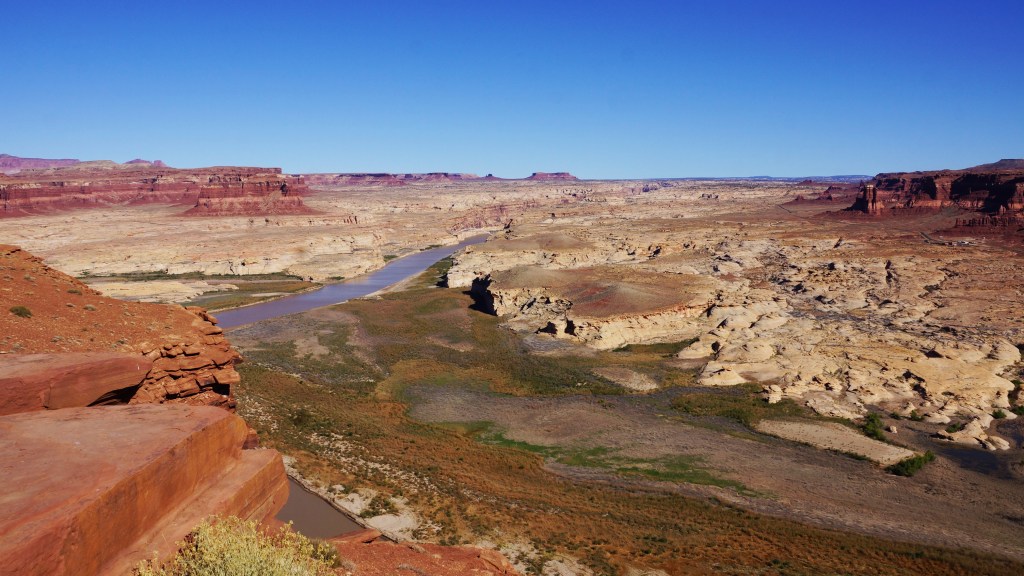
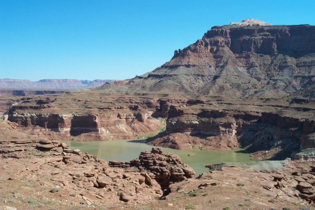
Hite Overlook
Continue south on UT‑95 for approximately 20–25 miles and look for the signed Hite Overlook pullout. This stop offers one of the most memorable views of the drive, where the Colorado River meets the upper reaches of Lake Powell, framed by broad canyon walls. The setting also carries some history—Hite was once a small riverside settlement, now largely submerged beneath Lake Powell, after the creation of Glen Canyon Dam. The overlook is an easy stop, just a short walk from the parking area, and well worth a few minutes to take in the scale of the terrain before continuing.
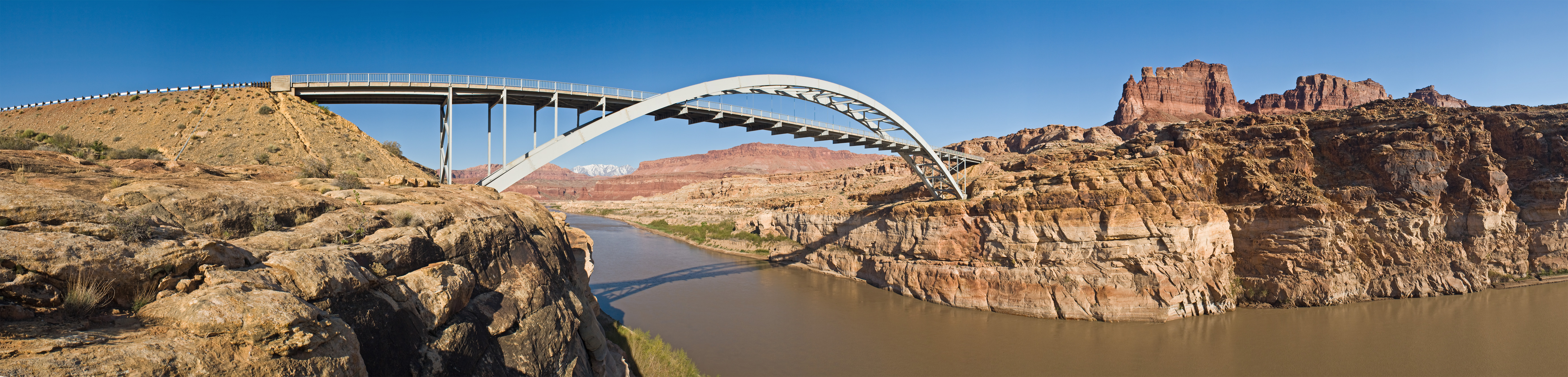
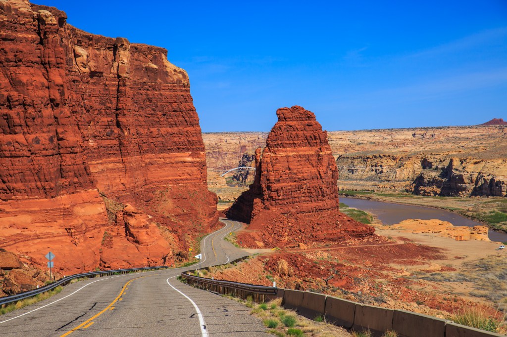
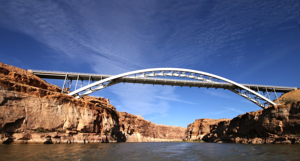
Colorado River Crossing at Hite
Continuing beyond the overlook, the road descends toward the Hite Crossing Bridge, where UT‑95 crosses the Colorado River. The bridge itself becomes the focal point here—a long, arching span set low within the canyon, placing you directly in the landscape rather than above it. This crossing marks an important transition point: the upstream reach of Lake Powell and the end of Cataract Canyon. It’s also one of the few places where you can cross the Colorado River by road in this part of Utah, with long distances to the nearest bridges in either direction.
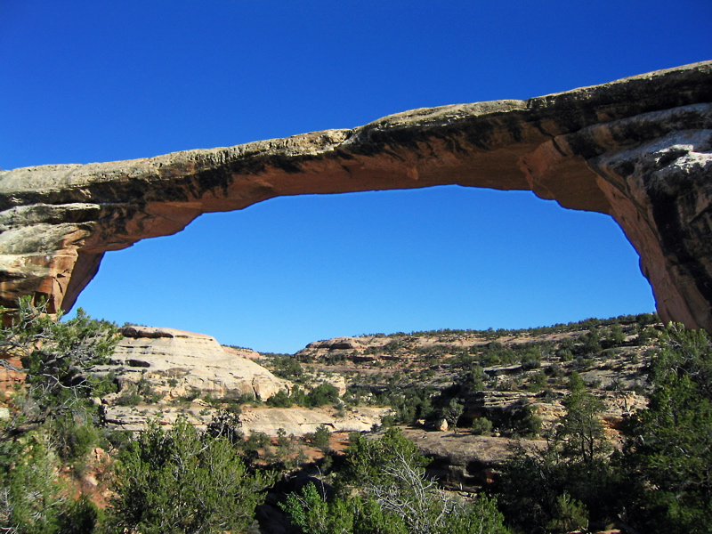
Natural Bridges National Monument
Continue on UT‑95 for approximately 40 miles beyond Hite and watch for the signed turnoff to Natural Bridges National Monument. This is one of the most worthwhile optional detours along the route and can add meaningful depth to the day if time allows. Stop at the Visitor’s center to plan your visit. A short scenic loop road of about 9 miles leads to a series of overlooks above three large natural stone bridges, each carved over time by flowing water through the canyon below. From the parking areas, short, well-marked walks of roughly 0.5 to 1 mile provide closer views and a better sense of scale. Even a brief stop at one of the primary overlooks—such as Sipapu or Kachina Bridge—offers a distinct visual contrast to Capitol Reef, with massive stone spans set within a deeper canyon landscape. Allow approximately 45 to 90 minutes depending on how much you choose to explore before returning to UT‑95 and continuing toward Blanding.
Fry Canyon
Continue south and east on UT‑95 for approximately 50–60 miles toward Fry Canyon and beyond. This segment is best experienced from the road. The terrain transitions again, moving from deeper canyon formations into broader desert plateaus dotted with sparse vegetation. You may pass Fry Canyon, a quiet outpost with limited or closed services, reinforcing the sense of isolation. The drive remains steady, with long stretches between any signs of activity.
Blanding
Continue on UT‑95 until it meets US‑191, then turn north and drive a few miles into Blanding. After moving through desert expanses and canyon environments, Blanding offers a simple place to settle in and unwind. It also serves as a convenient overnight stop for those planning to take the scenic drive toward Monument Valley and Page the following day. Check into your lodging and take the evening slowly, allowing the accumulation of the day’s scenery to settle in.
Continuing to Monticello or Moab (Optional Extension)
If your plans include exploring Arches or Canyonlands, you can rest overnight here or continue north on US‑191 Monticello lies about 20 miles ahead and offers a convenient intermediate stop, while Moab, approximately 75 miles from Blanding, provides a larger base with direct access to both parks. This extension builds naturally on the day’s drive, transitioning from the remote character of UT‑95 into one of southern Utah’s most iconic red rock regions.
Thanks for exploring with me!
I hope you enjoyed this sextended scenic drive through the remotte stretches of Utah’s Canyon country. If you enjoyed the route, found a hidden gem, or have ideas for improving the experience, I’d love to hear from you! Your insights help me improve future experiences and inspire fellow travelers. Please rate this walk using the stars below — and feel free to leave a comment. Thank you! — and happy exploring!


Click here for more JCV Walks & Rambles
Your journey doesn’t have to end here. Choose another experience and let’s keep exploring together—one step (or mile) at a time.
Zion National Park
Experience the canyon from within along riverside trails and scenic paths beneath towering sandstone walls. A balanced mix of easy walks and striking views, with an option to explore by bike or shuttle.
Bryce Canyon National Park
Walk the rim and descend among Bryce’s iconic hoodoos, where sculpted rock formations rise in vivid colors from the canyon floor. A mix of easy viewpoints and immersive trails offers a close-up experience of one of the Southwest’s most distinctive landscapes.ption
Scenic Byway 12 and Capitol Reef
Follow one of Utah’s most scenic roads as it winds across ridgelines, through red rock country, and over high mountain terrain before descending into Capitol Reef. A mix of short walks, viewpoints, and an easygoing park experience, where the landscape unfolds gradually rather than around a single landmark.
Photo Credits
- Hite Crossing Bridge Panorama. By Christian Mehlführer, Own work, CC BY 2.5
- Blue Cliffs. By Bob Palin – Own work, CC BY-SA 4.0
- Castle at Swingarm City by Бездомная Cобака on Google Maps
- Utah 24 By Ken Lund CC BY-SA 2.0,
- Hanksville By DXR – Own work, CC BY-SA 4.0
- Behunin Cabin By Tricia Simpson – Own work, CC BY-SA 3.0
- Gray Ones. By Ryan Cornia
- Factory Butte. By dconvertini – CC BY-SA 2.0,
- Utah 95 by Laurie Schmidt Utah Office of Tourism
- Hite Overlook. By NealVickers – Own work, CC BY-SA 4.0
- Hite Crossing Bridge. By Dreanaline – Own work, Public Domain
- Natural Bridge National Monument By Laban712 Public Domain
- Blanding, UT
- Glen Canyon. By Crevans Public Domain,
- Hog Springs Recreation Area by Kyle Crocker on Google Maps
