A Scenic Journey Across the Colorado Plateau
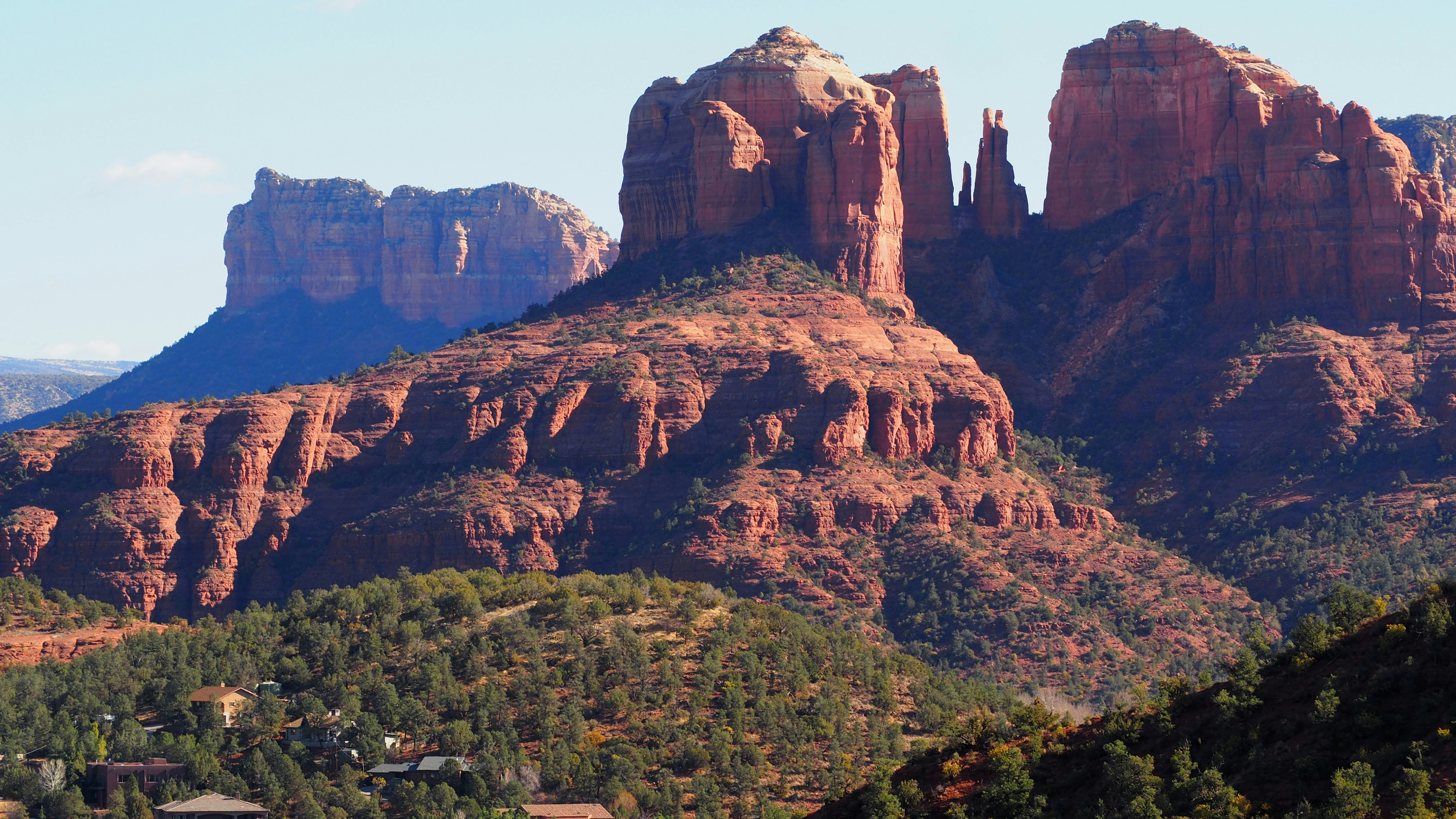
Some drives connect destinations. Others connect landscapes. This journey does both. Beginning among the hoodoos of Bryce Canyon and ending beneath the towering red rock formations of Sedona, the route traverses some of the most distinctive scenery in the American Southwest. Along the way, we’ll travel through high-elevation forests, sweeping desert valleys, sandstone cliffs, Lake Powell, Glen Canyon, and the lands of the Navajo Nation before descending into the dramatic beauty of Oak Creek Canyon. More than a drive between two destinations, this journey reveals how geology, water, and time have shaped an extraordinary region of North America. With thoughtfully selected stops along the way, we’ll experience the changing character of the landscape while enjoying some of the finest scenic roads in Utah and Arizona.
How to navigate with your mobile device
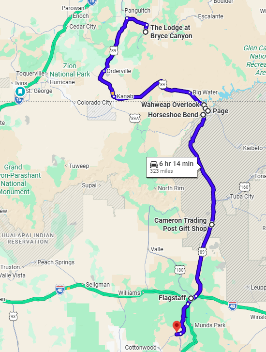
JCVWalks are designed to be easy to follow on your mobile device. As you travel from point to point, you can tap the header or photo for each point of interest to open the location directly in Google Maps. This will help you navigate from your current location to the next point of interest. If you’d like to learn more about any stop along the way, just click the links in the description for additional details and context.
Route Information
This journey follows US-89 south from Bryce Canyon through Red Canyon, Glendale, Orderville, Mount Carmel Junction, Kanab, Page, and Cameron before continuing toward Flagstaff. Near Flagstaff, we’ll transition to scenic AZ-89A and descend through Oak Creek Canyon into Sedona, one of Arizona’s most celebrated destinations. The route covers approximately 275 miles and can be driven in about five and a half hours without stops. With the featured points of interest, meals, viewpoints, and scenic pauses included in this guide, plan for a full day of exploration.
Bryce Canyon Sunrise Point
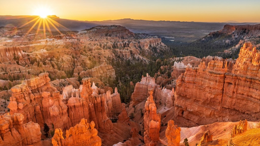
As a final moment in Bryce Canyon National Park before setting off on the next phase of our journey, Sunrise Point offers a quiet and fitting sendoff. Arrive as the sky begins to brighten and take a few moments along the rim as the hoodoos gradually come into focus. The colors build slowly, shifting from soft gold to deeper orange and red, bringing new definition to formations that now feel familiar. There’s no need to move around much; simply find a comfortable vantage point and take it in. It’s a calm, unhurried experience—an opportunity to close out your time in Bryce with a sense of stillness before the drive ahead. Allow about 30–45 minutes.
Red Canyon Arch
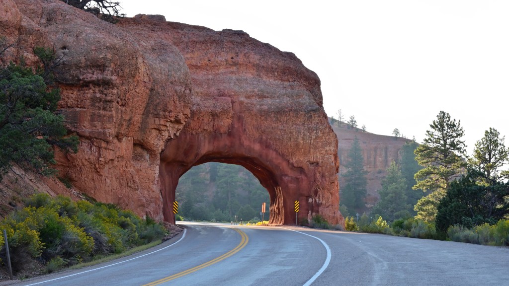
Leaving Bryce Canyon behind, we will travel west along Utah Scenic Byway 12 through Red Canyon, one of Southern Utah’s most beautiful gateway landscapes. The highlight is the iconic Red Canyon Arch, a striking sandstone formation that spans the highway itself. Driving beneath the arch feels like passing through a natural portal, marking the transition from Bryce Canyon’s hoodoo-filled amphitheaters to the broader landscapes of the Colorado Plateau. The surrounding cliffs display vibrant shades of red, orange, and pink, creating dramatic scenery even from the road. Small pullouts provide opportunities for photographs and a closer look at the formations. Though brief, this is one of those memorable roadside moments that perfectly captures the spirit of Southwest road travel.
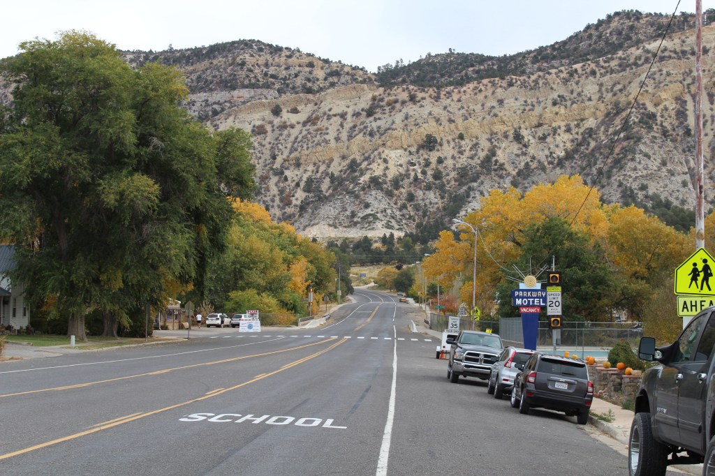
US-89 South: Through Glendale, Orderville, and Mount Carmel
From Red Canyon, we join US-89 and begin one of the most scenic stretches of highway in the Southwest. The route winds through broad valleys framed by colorful cliffs while passing the small communities of Glendale and Orderville. As the miles unfold, the landscape gradually shifts between forests, sandstone formations, ranchland, and open desert. This section of the journey provides a wonderful introduction to the scale and diversity of Southern Utah. Unlike the grand viewpoints that characterize many national parks, the beauty here unfolds naturally through the windshield, rewarding travelers who slow down and enjoy the changing scenery. It is an easy and enjoyable drive that connects Bryce Canyon with the adventure still ahead.
Mt. Carmel Junction
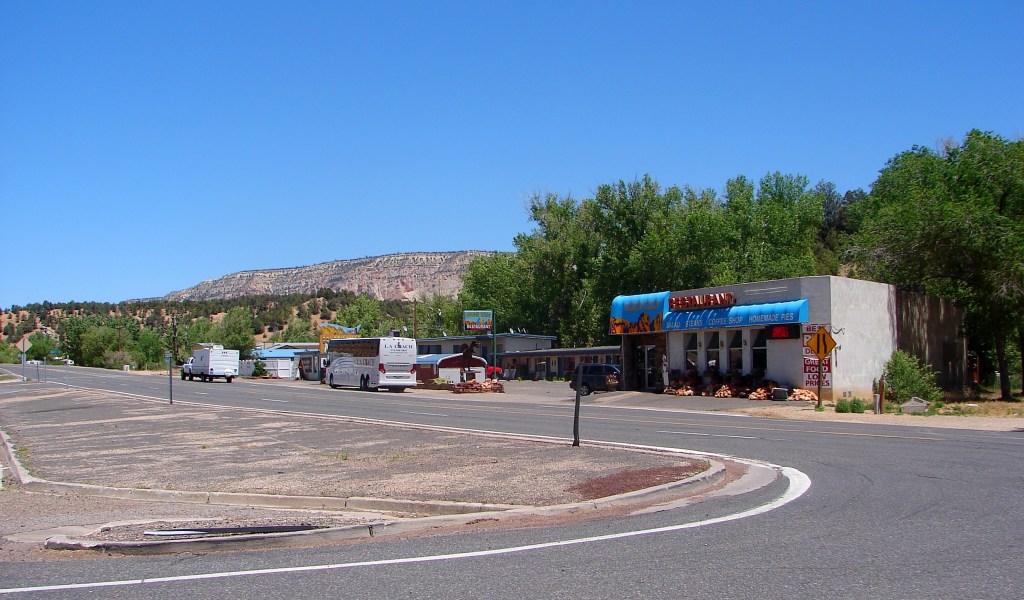
As we arrive at Mt. Carmel Junction, US-89 intersects with Utah State Route 9, the gateway to Zion National Park. A right turn here would lead toward Zion’s towering canyon walls and famous hiking trails, but our journey continues south toward Arizona. Even if we’re not entering Zion today, this crossroads serves as a reminder of how richly packed this region is with remarkable destinations. The surrounding landscape remains dramatic, with sandstone cliffs and desert mesas stretching toward the horizon. It is a good place to pause briefly, refuel if needed, and appreciate the geography that links Bryce Canyon, Zion, Page, and beyond.
Belly of the Dragon
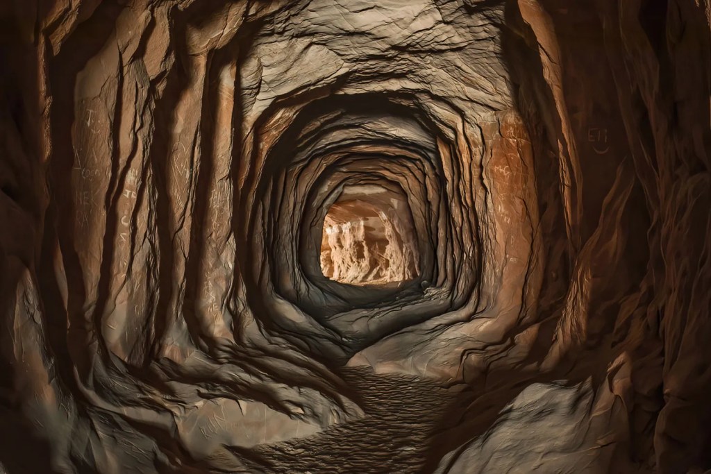
Just outside Mount Carmel Junction, consider a short stop at Belly of the Dragon, one of the area’s most unusual and unexpected attractions. Originally constructed as a drainage tunnel beneath Highway 89, the passage has become a favorite destination for photographers due to the rippling sandstone-like patterns carved into its interior walls. Walking through the tunnel creates the sensation of entering the belly of some giant desert creature, especially when sunlight streams through the openings at either end. The stop requires only a short walk from the parking area and offers a fun contrast to the grand natural landscapes featured elsewhere on the route. Allow approximately 20 to 30 minutes.
Kanab
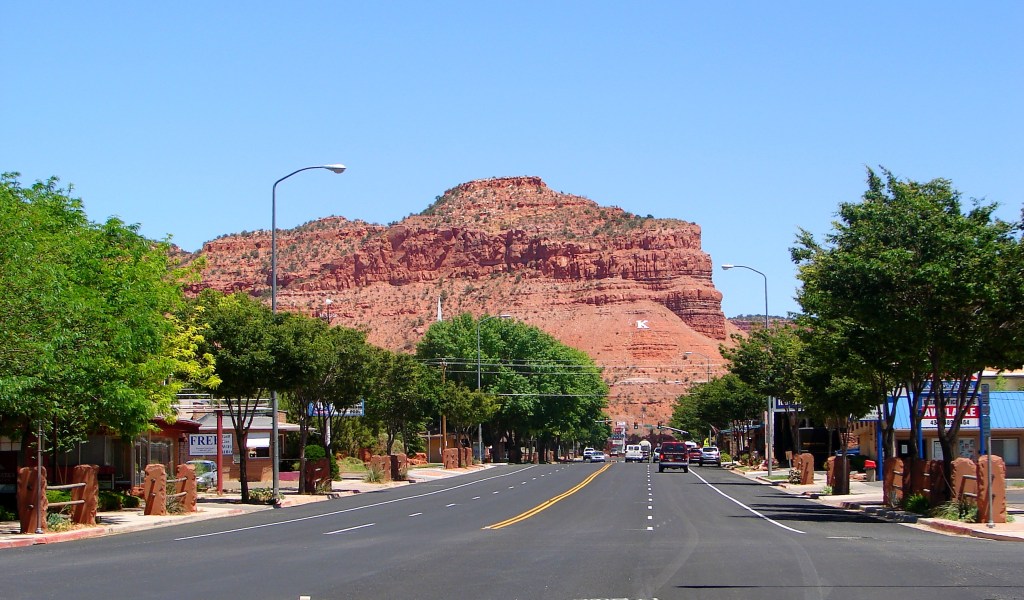
Continuing south, we’ll arrive in Kanab, often called “Little Hollywood” because of the many Western movies and television programs filmed in the surrounding landscape. Today, Kanab serves as a charming base for exploring Southern Utah’s canyon country while maintaining its relaxed small-town atmosphere. Historic buildings, local shops, cafes, and restaurants make this a pleasant place to stretch your legs and enjoy a break from the road. The town also marks an important transition in the journey, as we leave Southern Utah behind and begin moving toward Page and the landscapes surrounding Lake Powell. Allow time for lunch, a stroll through the downtown area, or a quick visit to the local visitor center before continuing south.
Optional Diversions
- Grand Canyon North Rim
- Canyon Country Loop
Wahweap Overlook
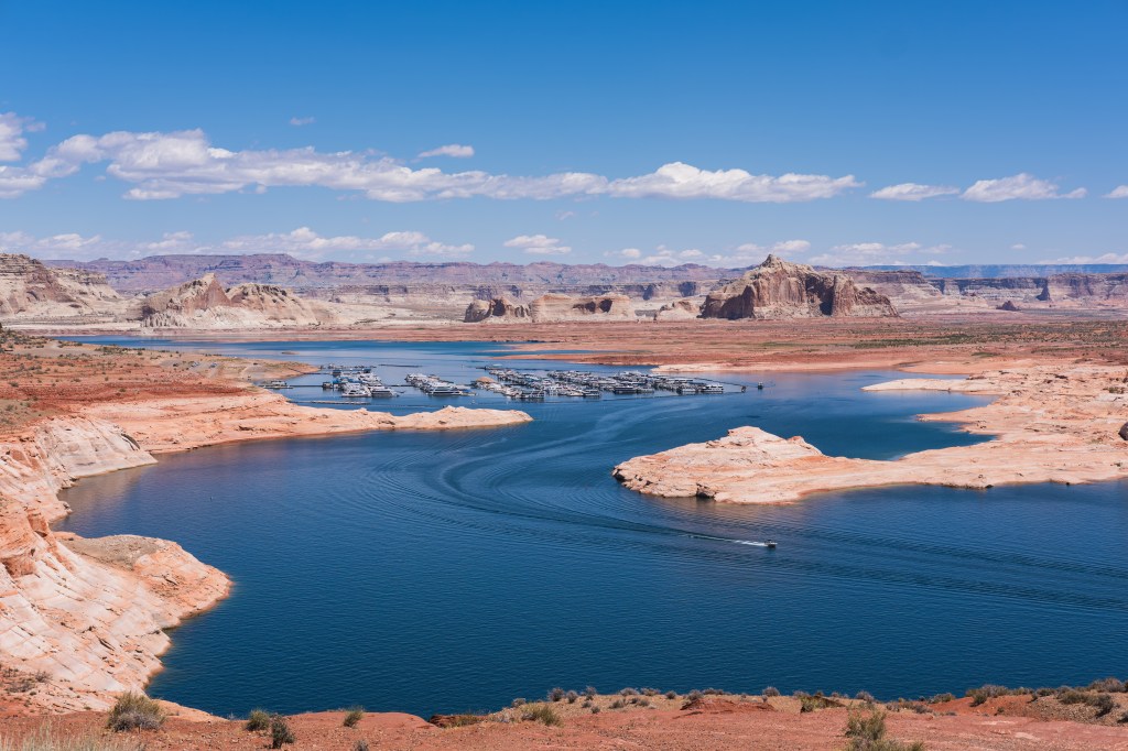
After leaving Kanab and crossing into Arizona, we’ll make a stop overlooking Lake Powell at Wahweap Overlook. Perched high above the lake, this viewpoint offers sweeping vistas of blue water winding between sandstone cliffs, with Navajo Mountain rising in the distance. It is one of the best places to appreciate both the scale of Lake Powell and the vast canyon landscape that surrounds it. Before reaching town, this overlook provides a memorable introduction to the geography that defines the Page area and sets the stage for the stops ahead. Allow approximately 10-20 minutes.
Carl Hayden Visitor Center & Glen Canyon Dam
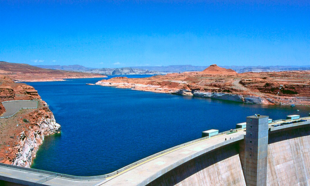
A short drive from Wahweap Overlook brings us to one of the most significant engineering projects in the American West. The Carl Hayden Visitor Center tells the story of Glen Canyon Dam, whose construction led to the creation of Lake Powell and the founding of modern Page. Exhibits and viewing areas explain how the dam transformed the Colorado River, and helped shape the economy and development of the region. Visitors can enjoy close-up views of the dam, Lake Powell upstream, and Glen Canyon stretching below. This stop provides valuable context for many of the landscapes we have encountered throughout the day and serves as a fitting final exploration before arriving in Page. Allow approximately 45 minutes to 1 hour.
Glen Canyon Dam Overlook
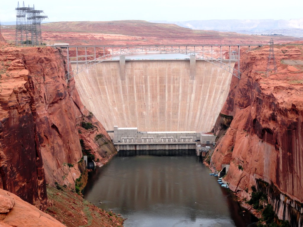
Before leaving the Glen Canyon National Recreation Area, we will stop at Glen Canyon Dam Overlook for one final perspective on the landscapes that define this corner of Arizona. A short trail across slickrock and sandstone ledges leads to a dramatic viewpoint overlooking Glen Canyon Dam, the Glen Canyon Bridge, and the Colorado River winding through the canyon far below. While the Carl Hayden Visitor Center explains the engineering story behind the dam, this overlook reveals its broader relationship to the surrounding landscape. From this vantage point, the immense scale of Glen Canyon becomes clear, providing a fitting final look at the region before continuing south.
Page
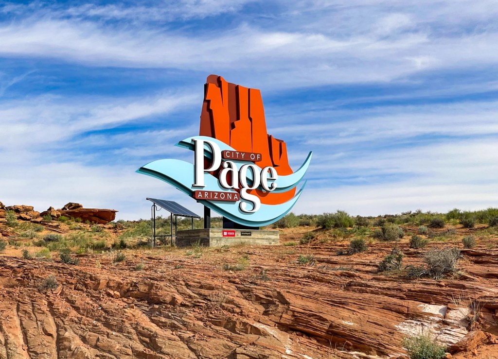
After completing our exploration of Glen Canyon and Lake Powell, we’ll arrive in Page, Arizona, one of the Southwest’s premier adventure destinations. Originally established to house workers building Glen Canyon Dam, Page has evolved into a gateway for exploring some of the region’s most iconic landscapes, including Antelope Canyon, Horseshoe Bend, Lake Powell, and the Colorado River. While modest in size, the city serves as an ideal base camp for discovering the wonders of Northern Arizona and the Colorado Plateau.
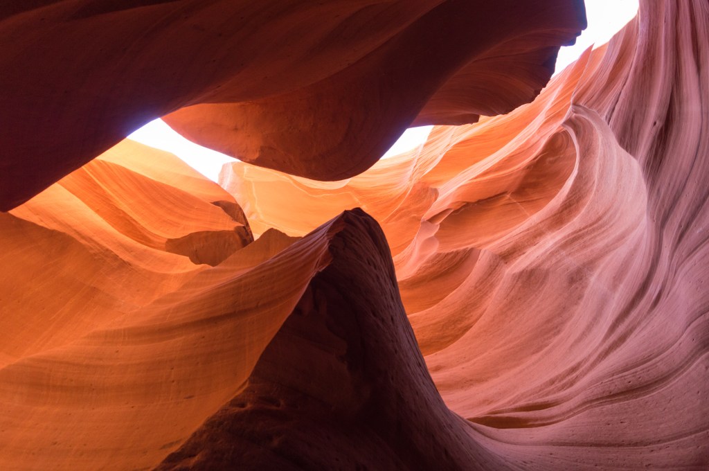
Antelope Canyon
If you have time and have made advance reservations, you can explore Antelope Canyon, one of the most extraordinary geological wonders in the American Southwest. Over thousands of years, flash floods carved narrow passageways through Navajo Sandstone, creating the flowing walls, rich colors, and sculpted forms that have made Antelope Canyon famous around the world. Whether you choose Upper Antelope Canyon, Lower Antelope Canyon, or the quieter Canyon X, each offers a unique opportunity to experience the beauty of a slot canyon shaped by water, time, and light. Guided tours are required for all visitors, providing valuable cultural and geological context while helping preserve this remarkable landscape. Even for travelers who have seen countless photographs, Antelope Canyon often becomes one of the most memorable experiences of the journey.
Antelope Canyon Options
- Upper Antelope Canyon – The most famous and accessible option. Its level floor and wider chambers make it suitable for most visitors, and it is particularly known for the dramatic light beams that appear at certain times of year.
- Lower Antelope Canyon – A more adventurous experience featuring stairways, narrow passageways, and intricate sandstone formations. Many visitors consider it the most visually interesting of the three canyons, though it requires greater mobility.
- Antelope Canyon X – A quieter and less crowded alternative that offers many of the same beautiful sandstone textures and colors found in the more famous canyons. Smaller groups and a more relaxed pace appeal to visitors seeking a less commercial experience.
Biidi The Arch
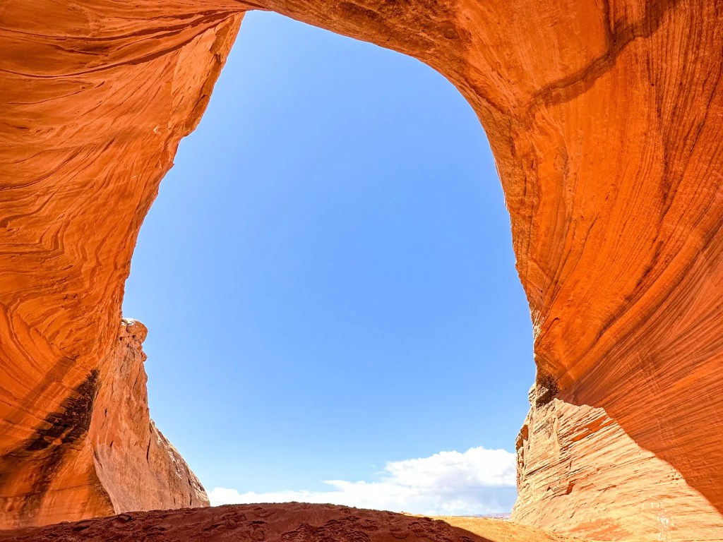
Another interesting site to see is Biidi The Arch, one of the area’s lesser-known treasures. Part of its appeal is that the sand cave is located behind the Big Lake Trading Post at the Shell station on AZ 98, making it easy to overlook despite being only a short drive from town. Once you pull into the lot, you’ll see a dirt road beyond the gas pumps. Follow this road to the left and park along the barbed wire fence. Do not take up spots for the trading post and gas station. Its a relatively easy hike across open desert terrain leads to a graceful sandstone arch overlooking the canyon country surrounding Page. Along the way, you’ll enjoy sweeping views of mesas, cliffs, and colorful rock formations while experiencing a welcome sense of solitude away from some of the region’s busier attractions. Located approximately 5 minutes from downtown Page. Allow 30-45 min for the hike, photography, and time to appreciate this rewarding hidden gem.
Horseshoe Bend
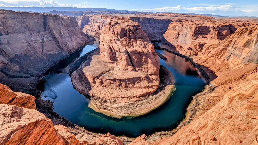
A key stop along this journey is Horseshoe Bend, one of the most recognizable landscapes in North America. A well-maintained trail leads to a dramatic overlook where the Colorado River completes a spectacular 270-degree turn around a sandstone butte nearly 1,000 feet below. The scale of the scene is breathtaking, with layers of red rock, open desert, and the emerald-green river creating one of the Southwest’s signature views. Located about 5 miles south of downtown Page, Horseshoe Bend is only a 10-minute drive from town. The walk to and from the overlook is about 1½ miles roundtrip, and most visitors will want to allow 45 minutes to 1 hour for the experience. Whether it’s your first visit or a return trip, the view never fails to impress.
Cameron Trading Post
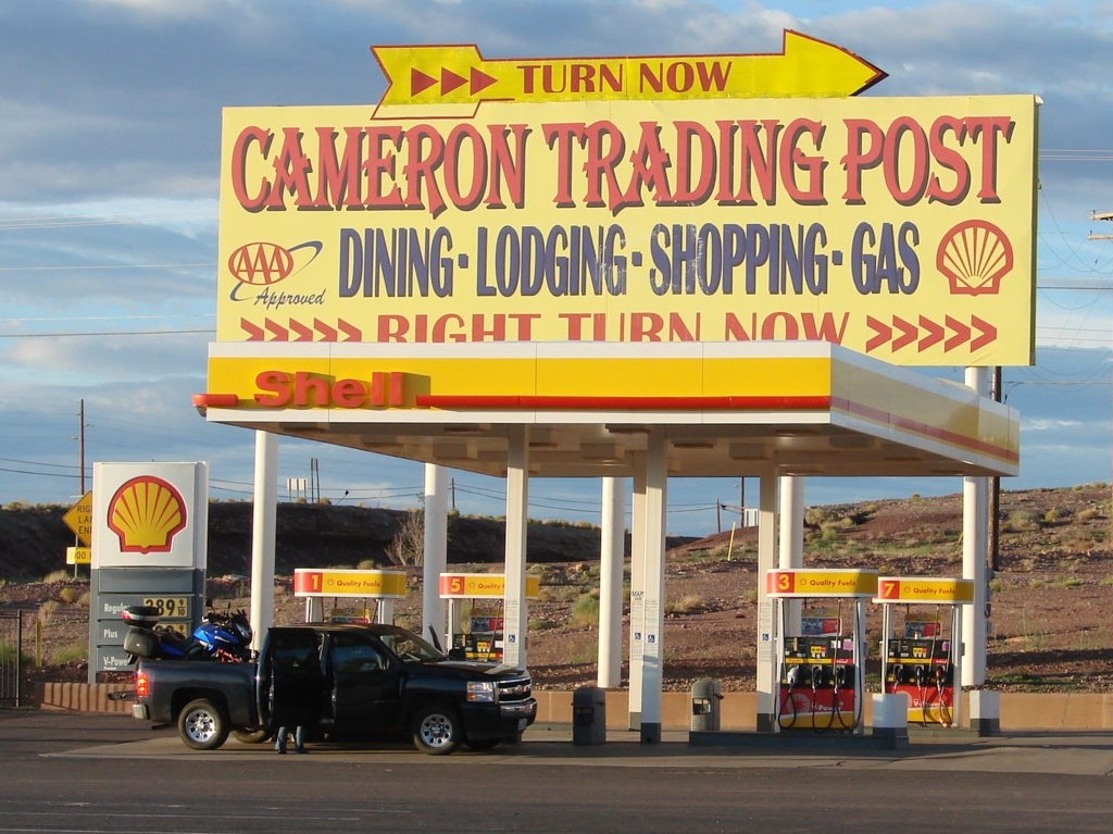
Continuing south on US-89 we arrive at Cameron Trading Post, a historic landmark that has welcomed travelers since 1916. Established as a trading center serving members of the Navajo Nation and passing visitors, it remains one of the best places to experience a connection to the region’s Indigenous culture. The trading post offers an extensive collection of Navajo rugs, jewelry, pottery, and artwork while continuing a tradition that played an important role in commerce throughout the Southwest. Situated near the crossing of the Little Colorado River, the property became a natural stopping place for travelers heading to the Grand Canyon. Today, visitors can browse authentic crafts, learn about local traditions, and enjoy a meal before continuing west toward the park, making this both a convenient and culturally meaningful stop along the route.
Cameron to Flagstaff
Leaving Cameron behind, the landscape gradually begins to change. The open desert of the Colorado Plateau slowly gives way to higher elevations, cooler temperatures, and the forests of Northern Arizona. As US-89 approaches Flagstaff, broad vistas of sagebrush and sandstone transition into stands of ponderosa pine, signaling our arrival at the southern edge of the Colorado Plateau. This section of the drive often surprises visitors with its dramatic change in scenery and serves as a reminder of the remarkable diversity found across Arizona.
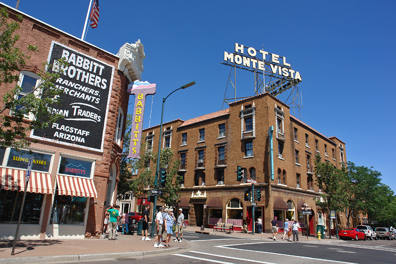
Flagstaff
Before continuing toward Sedona, we’ll take time to explore historic downtown Flagstaff. Centered around Heritage Square and the famous Route 66 corridor, downtown Flagstaff combines a lively mountain-town atmosphere with a rich railroad history. A short walk along San Francisco Street reveals locally owned shops, galleries, cafés, and historic buildings that reflect the city’s role as a gateway to many of Arizona’s most celebrated natural attractions. The combination of historic architecture, college-town energy, and mountain scenery creates a distinctive character unlike any other stop on this journey. Even a brief visit offers a pleasant opportunity to stretch your legs and experience a different side of Arizona. From US‑89, follow signs into Flagstaff and connect to Route 66 (Business Route I‑40), then turn onto San Francisco Street and park near Heritage Square (113 N San Francisco St) for easy access to downtown.
Oak Creek Canyon Scenic Drive
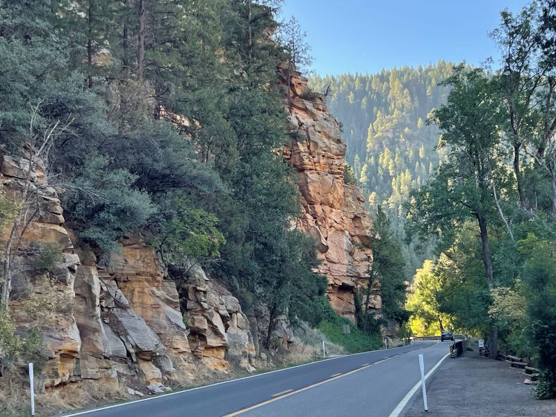
Departing Flagstaff, we’ll follow AZ-89A south through Oak Creek Canyon, widely regarded as one of Arizona’s most beautiful scenic drives. The road descends through a dramatic canyon carved between towering cliffs while winding through forests of pine, oak, and sycamore. Around each bend, new vistas emerge as the landscape gradually transitions from mountain forest to the red rock formations that define Sedona. The drive itself is an attraction, offering numerous viewpoints and roadside pullouts that invite travelers to pause and appreciate the changing scenery. It serves as a spectacular final chapter in a journey that has traversed deserts, canyons, lakes, mesas, and mountains.
Sedona
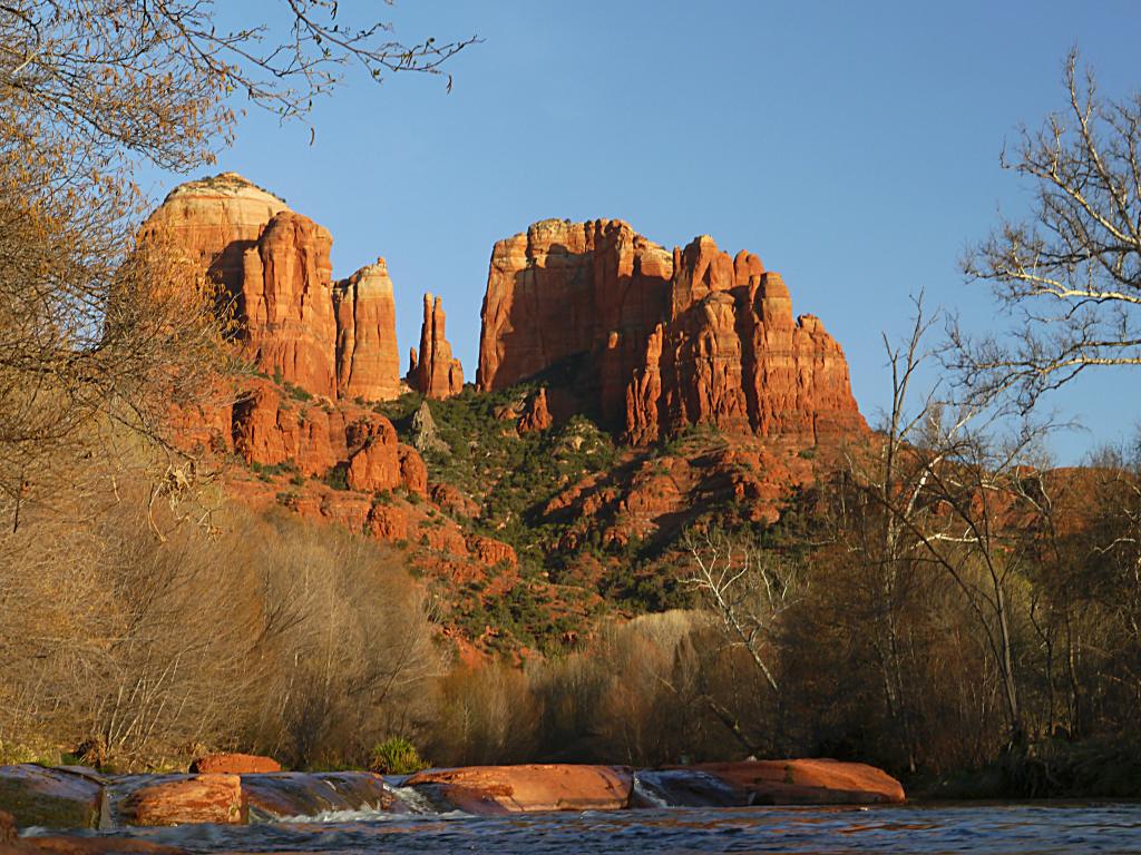
Today’s journey concludes in Sedona, where some of the most recognizable red rock landscapes in the American Southwest rise above the surrounding desert. Renowned for its dramatic scenery, hiking trails, art galleries, and spiritual atmosphere, Sedona offers a fitting finale to a drive that has highlighted the extraordinary geological diversity of Utah and Arizona. After days of moving through canyon country, Monument Valley, Lake Powell, and the high forests of Northern Arizona, Sedona provides one final reminder that in the Southwest, every landscape tells a story shaped by water, stone, and time.
Thanks for exploring with me!
From the hoodoos of Bryce Canyon to the red rocks of Sedona, we’ve traveled through some of the most spectacular landscapes in the American Southwest, experiencing the remarkable ways that water, stone, and time have shaped the land. I hope this route helped you discover more, plan less, and enjoy every mile along the way.
If you enjoyed the route, found a hidden gem, or have ideas for improving the experience, I’d love to hear from you! Your insights help me improve future experiences and inspire fellow travelers. Please rate this walk using the stars below — and feel free to leave a comment. Thank you! — and happy exploring!


Click here for more JCV Walks & Rambles
Your journey doesn’t have to end here. Choose another experience and let’s keep exploring together—one step (or mile) at a time.
Zion National Park
Experience the canyon from within along riverside trails and scenic paths beneath towering sandstone walls. A balanced mix of easy walks and striking views, with an option to explore by bike or shuttle.
Bryce Canyon National Park
Walk the rim and descend among Bryce’s iconic hoodoos, where sculpted rock formations rise in vivid colors from the canyon floor. A mix of easy viewpoints and immersive trails offers a close-up experience of one of the Southwest’s most distinctive landscapes.ption
Monument Valley
Travel through one of the American Southwest’s most iconic landscapes, where towering sandstone buttes, sweeping desert vistas, and Navajo Nation history combine to create an unforgettable scenic drive. Along the way, you’ll experience famous viewpoints, hidden gems, and some of the most recognizable scenery in the world.
Photo Credits
- Sedona by Marco Topete on Unsplash
- Sunrise Point By King of Hearts – Own work, CC BY-SA 4.0
- Red Canyon Arch by Andrew Heneen, CC BY 4.0
- US‑89 North by Bill Golladay, CC BY-SA 4.0
- Mt. Carmel Junction by P199, CC BY-SA 3.0
- Belly of the Dragon by eastzion.com
- Kanab, UT by P199 – Own work, CC BY-SA 3.0
- Wahweap Overlook by Christian David – Own work, CC BY-SA 4.0
- Glen Canyon Dam By W. Bulach – Own work, CC BY-SA 4.0
- Glen Canyon Overlook By Fabio Achilli from Milano, Italy CC BY 2.0
- Page, AZ by Adri on Travel Tip Zone
- Biidi the Arch by VisitPageAz
- Antelope Canyon By Supercarwaar – Own work, CC BY-SA 4.0
- Horseshoe Bend By Charles Wang – Own work, CC BY-SA 4.0
- Cameron Trading Post Stop By inkknife_2000 CC BY-SA 2.0
- Flagstaff, AZ By SearchNet Media CC BY 2.0
- Oak Creek Canyon Scenic Drive. By National Scenic Byway AssociationCathedral Rock – Sedona By Terrydarc Own work, CC BY-SA 3.0
